0333L-FRIDAY OUTLOOK FROM GARFIELD COUNTY EMERGENCY MANAGEMENT-2/11/22
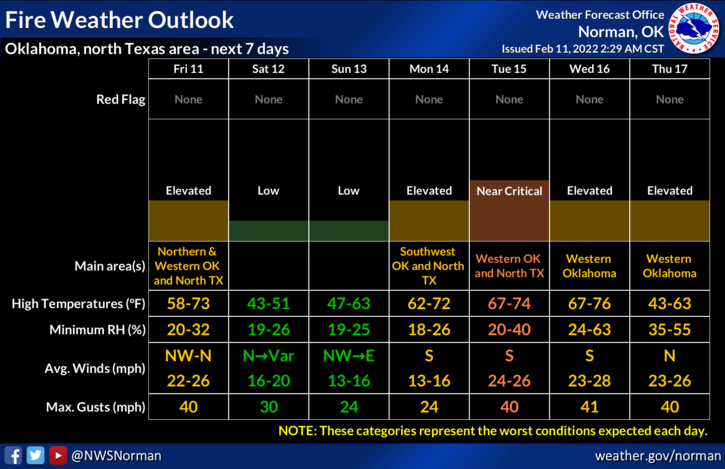
1- FIRE DANGER statement has been issued. SEE LINK- https://forecast.weather.gov/product.php?site=NWS&issuedby=OUN&product=FWF
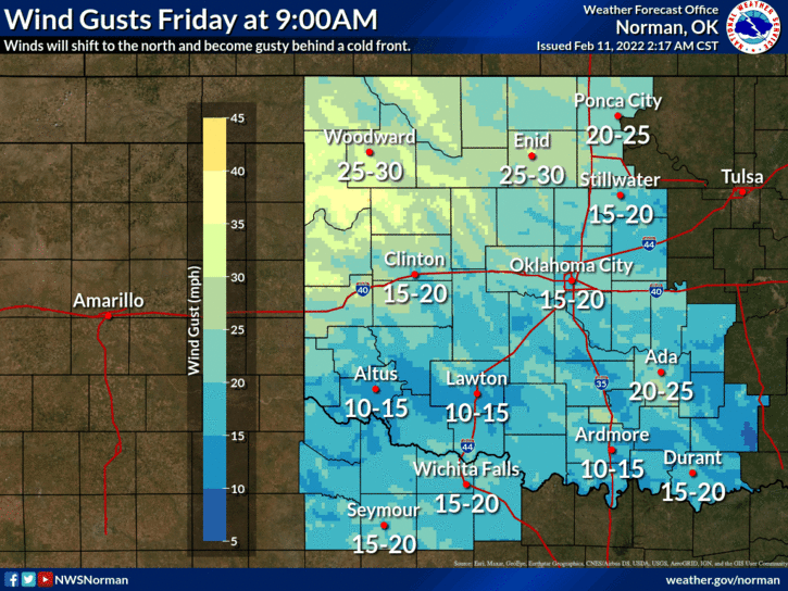
2- A cold front will push through the area this morning shifting winds to the north and they will be gusty. The fire danger will increase along with winds gusting into the 25-30 mph range so we ask that no controlled burning occur today. No precip is expected so stay out of the wind and you be mostly safe from the dirt.
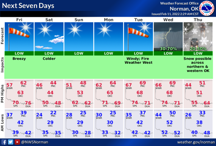
3- Overall, we’ll be ok and colder air will filter in tonight behind this front. Here is your forecast from the NWS/NORMAN;
Today-Mostly sunny. Highs in the lower 60s. Northwest winds 10 to 20 mph shifting to the north 20 to 25 mph in the afternoon.
Tonight-Partly cloudy. Colder. Lows in the lower 20s. North winds 15 to 20 mph with higher gusts.
HAVE A GOOD DAY AND REMEMBER TO CALL 911 IF YOU SEE SMOKE OR FIRE.