0330L-SATURDAY OUTLOOK FROM GARFIELD COUNTY EMERGENCY MANAGEMENT-2/12/22
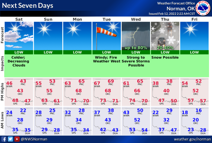
1- A trough has moved through the area bringing with it, much colder air. We’ll see highs in the low to mid-40s today with strong north winds once again. We’ll clear off this evening and winds will become southerly as we wait for the next front Sunday evening. Wind chill temps this morning will be low so be sure to take precautions while outdoors.
2- The Fire Danger still exists so keep an eye out for smoke and fire and call 911 asap so the proper response can be sent. Along this line, if a fire is occurring out there, please do not become a looky-loo. Heavy traffic can slow down a response that could cost someone their home, vehicle, or their life.
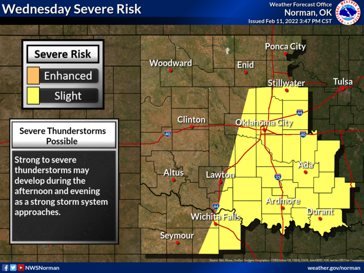
3-Let’s talk Wednesday and Thursday. There is a “chance” for rain & thunderstorms on Wednesday and as a cold front pushes in overnight, that precip could change over to a little winter precipitation. It WON’T be the end of the world and there’s no need for panic. Maybe one day the tv weather folks will go into teaching mode to help folks understand the weather a little better instead of panic mode. Probably not in my lifetime.
4- Overall, we’ll be ok so grab a coat if you are going outside. Here is your forecast from the NWS/NORMAN;
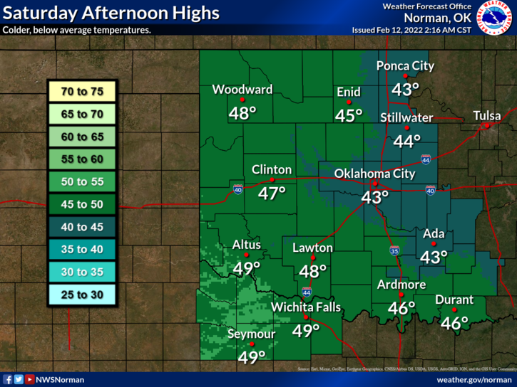
Today-Partly cloudy early in the morning then clearing. Cooler. Highs in the mid-40s. North winds 10 to 20 mph with higher gusts.
Tonight-Clear. Lows in the mid-20s. Southwest winds 10 to 15 mph with higher gusts.
HAVE A GOOD DAY!!