0350L-SATURDAY OUTLOOK FROM GARFIELD COUNTY EMERGENCY MANAGEMENT-2/13/21
GARFIELD COUNTY EM is our notification app. NOW is a good time to download it.
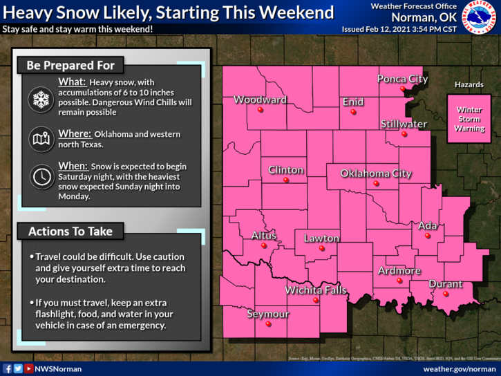
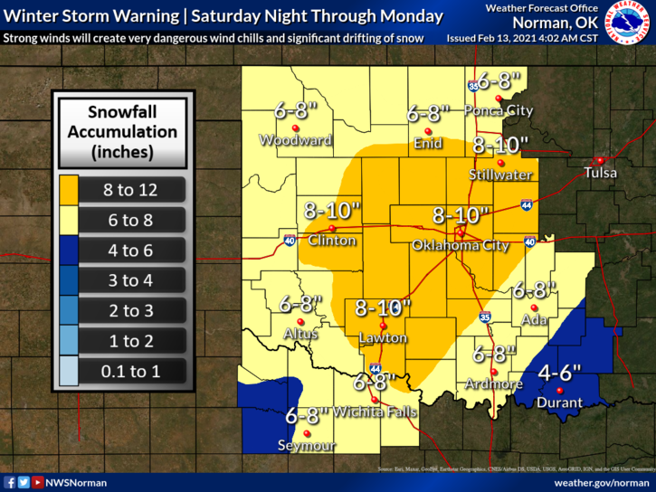
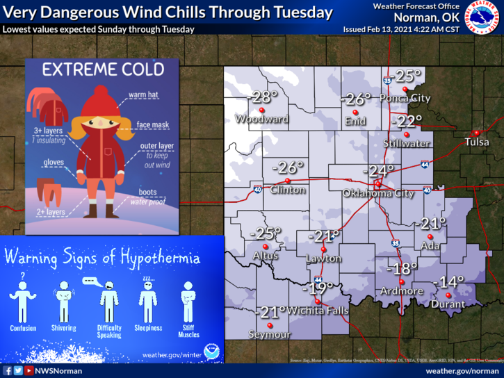
1-WINTER STORM WARNING in effect from MIDNIGHT TONIGHT UNTIL 6pm on MONDAY. DANGEROUS WIND CHILLS and heavy snow are expected. Per guidance from the NWS, snow accumulations could be around 5-10 inches with VERY DANGEROUS WIND CHILL TEMPS FROM 20 TO 30 BELOW ZERO are expected Monday and Tuesday mornings.
2- WIND CHILL ADVISORY still in effect until MIDNIGHT TONIGHT for wind chill TEMPS TO -15 DEGREES.
3- Without going into detail as I have the last several days, heavy snowfall will start sometime after midnight tonight and continue into Monday. Right now, the exact STORM TRACK is still questionable. Where will banding occur if at all, that’s questionable too. All that matters right now is the extremely dangerous wind chill temps and the hazardous driving potential. We can’t stress this enough that if you don’t have to be out, especially on Sunday and Monday, STAY HOME. You should have extra everything if you plan on traveling which we highly DISCOURAGE. Understand that if you get into a bind, you may be there for awhile as we will have some issues getting to you too.
4- Finally, we don’t normally experience this kind of cold all of the time and it’s important that everyone take whatever precautions to stay warm. Protect your outdoor animals AND CHECK ON YOUR NEIGHBORS. Here is your forecast from the NWS/NORMAN;
Saturday-A slight chance of flurries before noon. Cloudy and cold, high near 10. Wind chill values as low as -11. North northeast wind 10 to 15 mph, with gusts as high as 20 mph.
Saturday Night-40 percent chance of snow after midnight. Low around 4. Wind chill values as low as -13. Northeast wind 10 to 15 mph, with gusts as high as 25 mph.
STAY WARM AND I’ll SEND AN ADVISORY OUT AFTER OUR BRIEFING AT NOON.
MIKE