0423L-FRIDAY MORNING UPDATE FROM ENID/GARFIELD COUNTY EMERGENCY MANAGEMENT-7/13/18
1-We experienced a few showers and thunderstorms on Thursday afternoon. There wasn’t any severe weather in Garfield County but there was in other areas of the state. We do have that possibility later tonight and at times over the weekend. We aren’t in a HEAT ADVISORY yet but it wouldn’t surprise me if we end up in one today. Be careful out in the heat. PACE YOURSELF while working outdoors.
2- The weather pattern that we are stuck in causes us to have high humidity and light winds thus when storms occur, we end up with a variation of threats and very slow moving storms. Those are noted in number 4 below.
3- I received 1/10th of an inch of rain yesterday so let me know what you received. The storm activity seemed to be basically in the NNW QUADRANT of Enid and the county.
4-If storms occur later today, tonight, and over the weekend, torrential rainfall, intense lightning, some hail, and then strong to severe winds will be possible. The wind issue would most likely be from collapsing storms, which can occur frequently at this time of the year.
5- All this said, we’ll be ok. Just stay Weather Aware and adjust accordingly if storms occur. Be sure to check the weather forecast if you plan on traveling. Don’t get caught out in a bad situation.
6- IF YOU CAN HEAR THUNDER, YOU CAN BE STRUCK BY LIGHTNING!
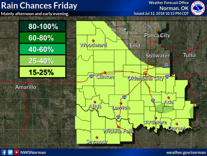
7- Here is your forecast from the NWS/NORMAN;
Friday-Sunny and hot with highs around 98. Heat index values around 103. South winds 5 to 15 mph.
Friday Night-20 percent chance of showers and thunderstorms late. Partly cloudy with lows around 76. South winds 5 to 15 mph.
HAVE A SUPER DAY!!
MIKE