0415L-SATURDAY UPDATE FROM ENID/GARFIELD COUNTY EMERGENCY MANAGEMENT-7/14/18
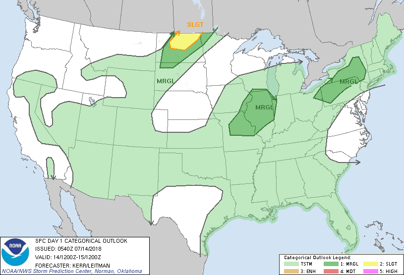
WE ARE IN A GENERAL THUNDERSTORM RISK AREA MEANING THAT STORMS COULD OCCUR ANYWHERE AROUND OUR AREA, SO BE PREPARED FOR THIS. IF STORMS OCCUR, WIND AND HAIL WOULD BE THE MAIN THREATS MAINLY THIS AFTERNOON AND TONIGHT.
1-A weak boundary will be in the area today and may become a focus point in thunderstorm development. As I type this morning at 0400, there are some showers around northern Oklahoma. Nothing severe at this time. We’ll see how this comes together later today.
2- Hot and muggy conditions are the main issues for today and the foreseeable future so pace yourselves while working outdoors and make sure any outdoor animals have plenty of fresh water and shade. REMEMBER TO STAY HYDRATED!!
3-Overall, we’ll be ok so just understand there will be some storms in the area. We will survive!!
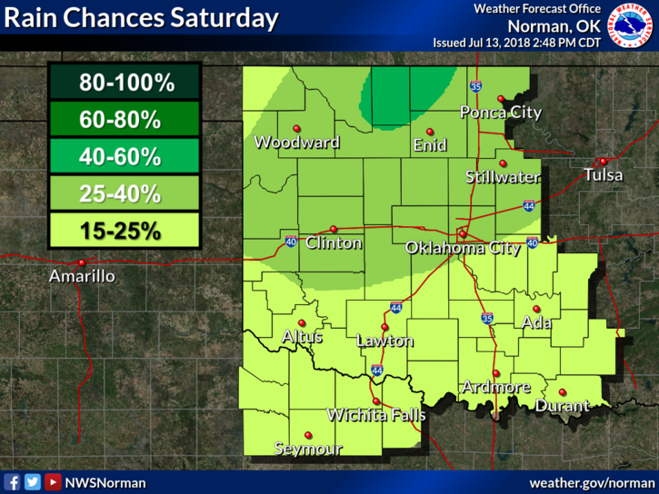
4- Here is your forecast from the NWS/NORMAN;
Saturday-Scattered showers and thunderstorms. Partly sunny with a high near 92. South wind 5 to 10 mph. Chance of precipitation is 30%.
Saturday Night- 40 percent chance of showers and thunderstorms. Mostly cloudy with a low around 75. South southeast wind 5 to 15 mph.
HAVE A SUPER DAY!
MIKE