0355L-FRIDAY INFO FROM ENID/GARFIELD COUNTY EMERGENCY MANAGEMENT-6/22/18
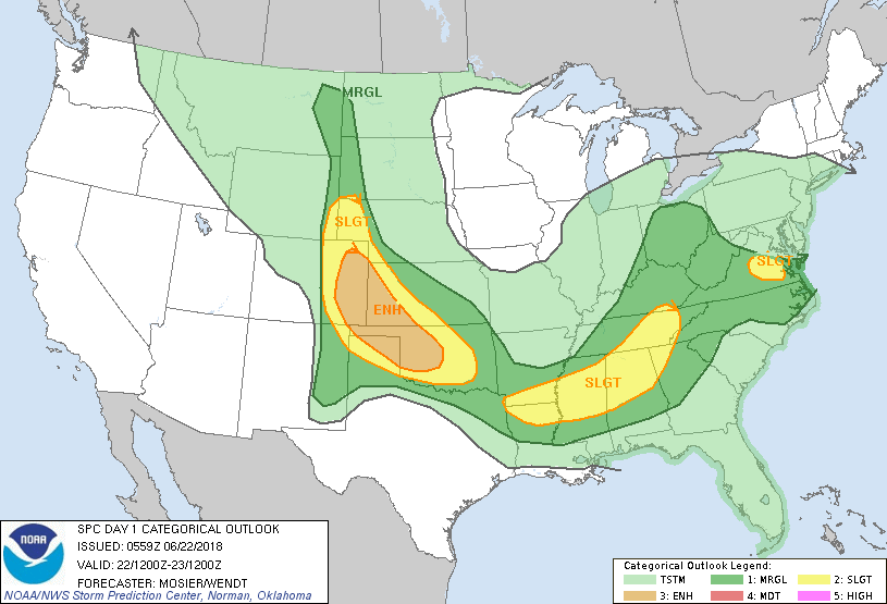
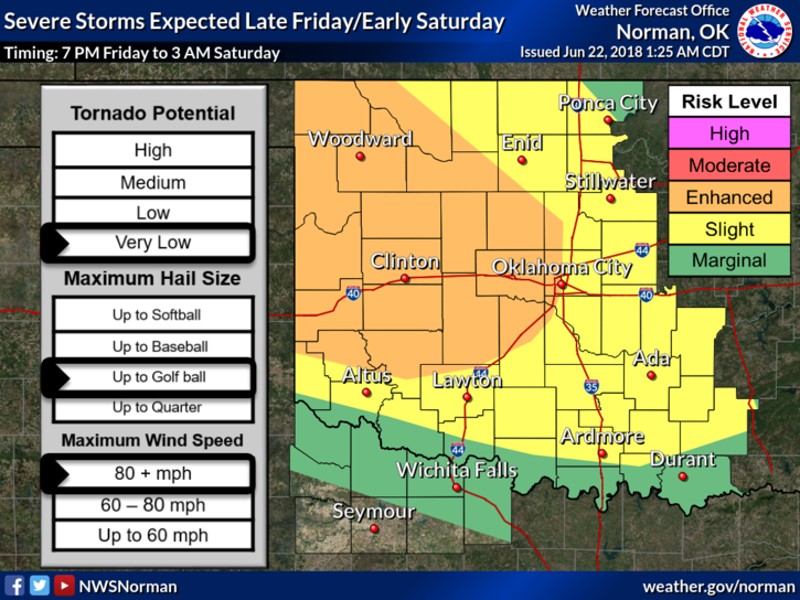
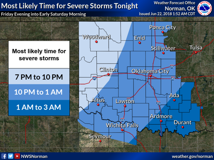
1- WE ARE IN AN “ENHANCED AND SLIGHT RISK AREA FOR SEVERE WEATHER LATER TODAY AND OVERNIGHT. The tornado threat is very low but large hail and winds to 80 mph are possible. A lot depends on where the (MCS) MESO CONVECTIVE SYSTEM tracks later tonight. There is also a slight chance for thunderstorms this morning. We’ll keep an eye out on this too.
2- See graphs below and understand that these WILL CHANGE some during the day. I will post these changes as I can.
3- I will go live on Facebook on the ENID/GARFIELD COUNTY EMERGENCY MANAGEMENT PAGE—“@EGCEM” DURING THIS SEVERE WEATHER EVENT. Those of you on my personal page will need to go to @EGCEM, LIKE AND FOLLOW THIS PAGE. It’s difficult to do live on both pages during these events. I may do a short video this morning explaining this for those that don’t read this post completely.
4- It will be hot and humid so be careful outside and especially over the weekend. STAY HYDRATED!!
5- Here is your forecast from the NWS/NORMAN;
Today… Partly cloudy with highs in the lower 90s. Light and variable winds becoming southeast around 10 mph this afternoon.
Tonight… Showers and thunderstorms mainly in the evening. Some thunderstorms may be severe. Lows in the upper 60s with east winds around 10 mph. Chance of precipitation 80 percent.
STAY COOL AND HAVE A SUPER DAY!!
MIKE