0430L-SATURDAY UPDATE FROM ENID/GARFIELD COUNTY EMERGENCY MANAGEMENT-6/23/18
1-WE ARE IN A MARGINAL RISK FOR MORE SEVERE WEATHER LATER TODAY. The brunt of it appears to affect the southeast area of the state. Since there is ongoing convection this morning, targeting an exact area of storm initiation later today is difficult per guidance so this info will change as the day progresses.
2- As many found out that went to the lake, severe winds, and hail can wreak havoc on trailers and tents. I am not aware of damage around any lake but if you received the winds as we did here in the NW part of the state, you definitely got a free rocking.
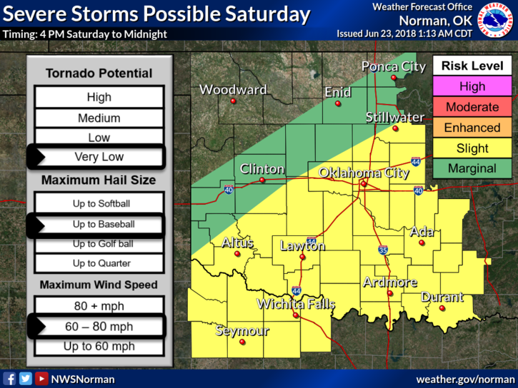
3- Threats later today will be WIND-60-80 MPH, HAIL, and the tornado threat is VERY LOW. This should be to our east.
4- IF YOU SUSTAINED DAMAGE HERE IN GARFIELD COUNTY, please report it to us via the Damage Report icon on the app OR EMAIL IT TO ME AT mike@gcem.org
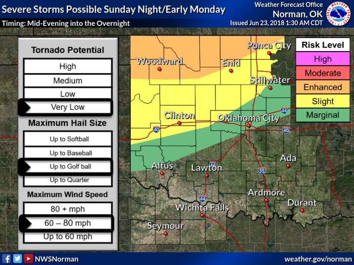
5-For SUNDAY- we will be in a higher risk for severe weather similar to last night so be prepared for that.
6- Here is your forecast from the NWS/NORMAN;
Saturday-30 percent chance of showers and thunderstorms before 7am. Partly sunny, with a high near 86. Northeast wind 5 to 8 mph.
Saturday Night-Mostly clear, with a low around 72. East northeast wind 6 to 8 mph becoming southeast after midnight.
HAVE A GOOD DAY AND REPAIR WHAT BROKE LAST NIGHT.
MIKE