0320L-FRIDAY OUTLOOK FROM GARFIELD COUNTY EMERGENCY MANAGEMENT-5/22/2020
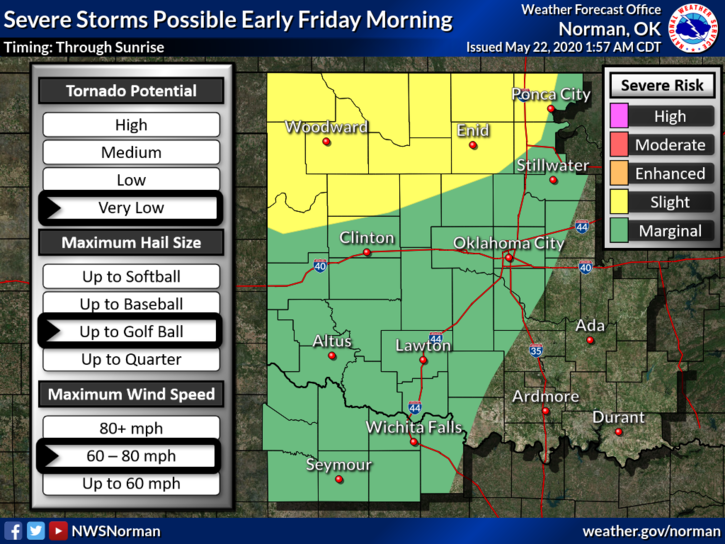
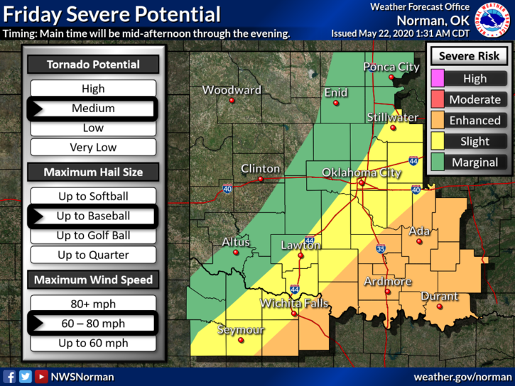
1- SLIGHT RISK for severe weather early this morning through roughly sunrise and then we’ll be in a MARGINAL RISK THROUGH THE REST OF THE DAY. SEE ATTACHED GRAPHS.
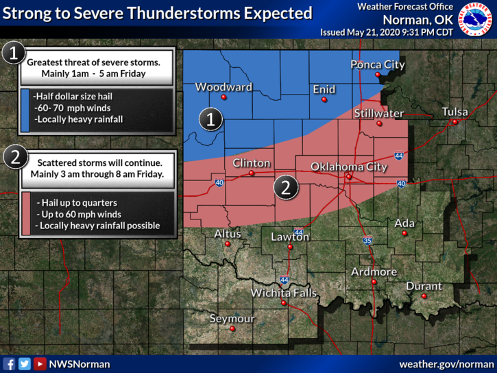
2- As I type severe weather will impact the county shortly. We are presently in a severe thunderstorm warning for winds gusts upwards to 70 mph and possibly 1 inch hail. This line will move southeast at 20-25 mph. We should see some heavy rainfall out of this too. Be careful in low lying areas as flooding may occur as this system moves through.
Here is your forecast from the NWS/NORMAN:
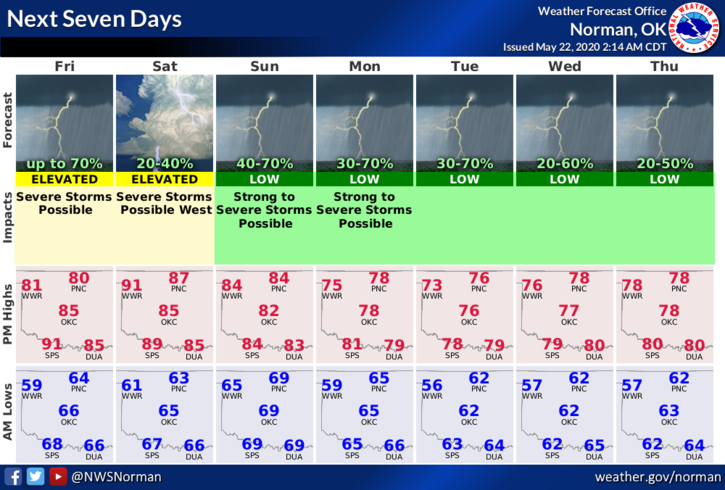
Today-Cloudy with a chance of thunderstorms early in the morning, then partly cloudy in the late morning and afternoon. Highs in the lower 80s. East winds 10 to 15 mph shifting to the southwest in the afternoon. Chance of thunderstorms 50 percent.
Tonight-Mostly clear. Lows in the lower 60s. Northeast winds around 10 mph shifting to the south after midnight.
HAVE A GOOD DAY AND WE’LL ADVISE AS NEEDED.
MIKE