0415L-THURSDAY OUTLOOK & INFO FROM GARFIELD COUNTY EMERGENCY MGMT-05/21/2020
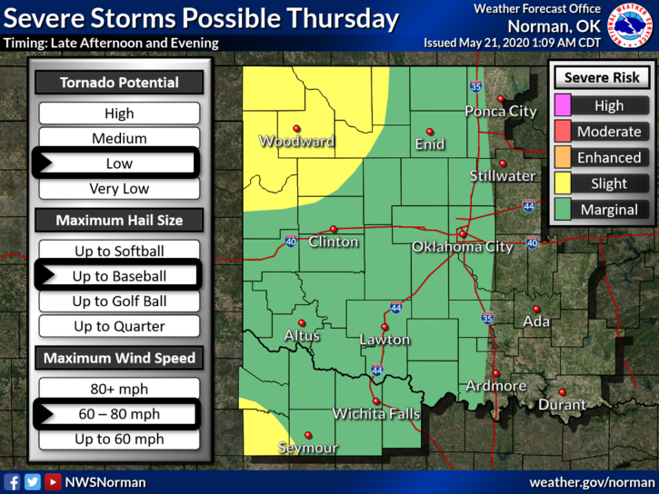
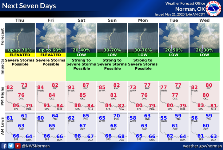
1- We are in a MARGINAL RISK for severe weather today through the weekend. It won’t rain here the whole time but hopefully we get some rain. The next several days of weather will depend on the previous day’s weather event so we’ll see what happens. Deep moisture is still south of us in Texas and will struggle to move north but we have enough moisture to make it interesting IF STORMS DO OCCUR. That said, the tornado risk for us is very low. Overall, the next several days look to be interesting so stay up with the latest forecasts wherever you are or where you’re going and we’ll advise as needed.
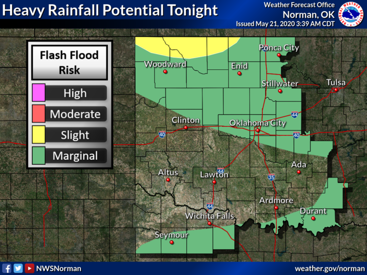
2- The heavier weather for tonight looks to be centered over our panhandle so if you are headed that way for tonight, just be careful. Here is your forecast from the NWS/NORMAN;
Today- Cloudy with a chance of thunderstorms. Highs in the mid-70s. Southeast winds 10 to 15 mph. Chance of thunderstorms 50 percent.
Tonight- Mostly cloudy with a chance of thunderstorms. Lows in the lower 60s. Southeast winds 10 to 15 mph. Chance of thunderstorms 50 percent.
FINALLY, Make sure you have our GARFIELD COUNTY EM app so you can stay up to date from us and the NWS.
HAVE A GOOD DAY!!
MIKE