0445L-THURSDAY OUTLOOK FROM GARFIELD COUNTY EMERGENCY MANAGEMENT-5/23/19
GARFIELD COUNTY EM = PROTECTIVE INFORMATION FOR YOU AND YOUR FAMILY.
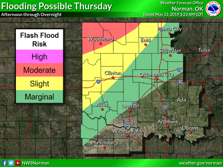
FLOOD WATCH THROUGH FRIDAY AT 1PM. THIS MAY BE EXTENDED. Any extended thunderstorm activity over already saturated ground will cause flooding issues all around the region. Use extreme caution and plan your traveling carefully.
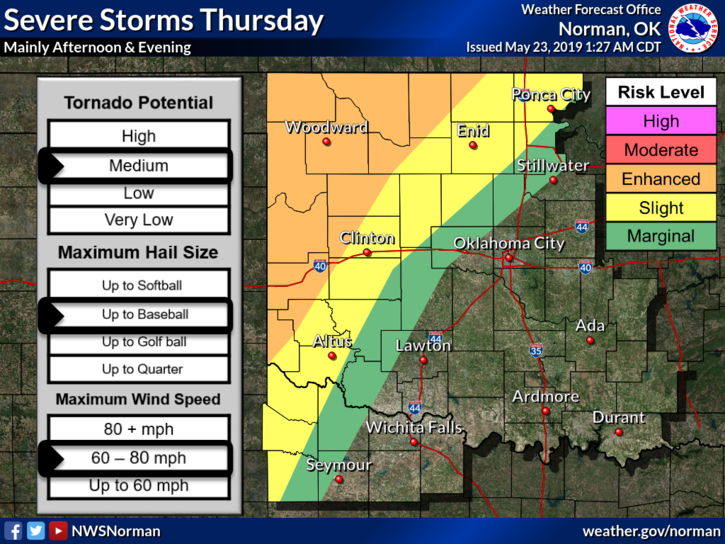
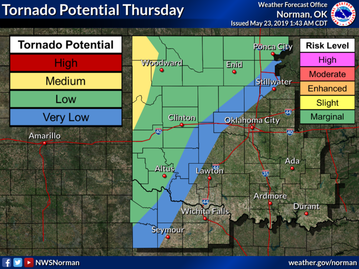
1- WE ARE IN A SLIGHT RISK FOR SEVERE WEATHER LATER TODAY. We’re not too far from the ENHANCED RISK area. Main threats this afternoon are large hail, damaging winds, torrential rainfall, and a medium risk for tornadoes.
2- Spotters will remain on stand-by until further notice. We did deploy 3 teams for a short time last evening but storms moved out fairly quickly.
3- Until new data comes in and we have our briefing this morning, I’ll update information as we receive it.
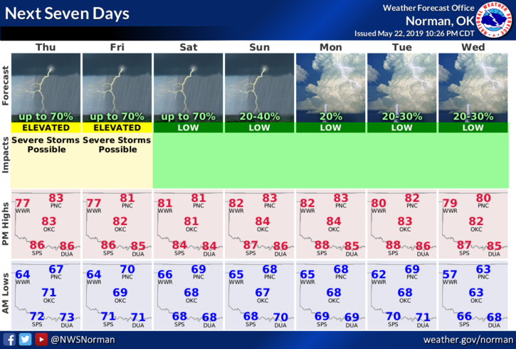
4- Here is the countywide forecast from the NWS/NORMAN;
Today-Mostly cloudy with a chance of thunderstorms early in the morning, then thunderstorms likely in the late morning and early afternoon. A chance of thunderstorms late in the afternoon. Highs around 80. South winds 10 to 15 mph. Chance of thunderstorms 70 percent.
Tonight-Mostly cloudy with a chance of thunderstorms. Lows in the upper 60s. South winds 10 to 15 mph. Chance of thunderstorms 50 percent.
HAVE A GOOD DAY
MIKE