0415L-FRIDAY UPDATE/OUTLOOK FROM ENID/GARFIELD COUNTY EMERGENCY MANAGEMENT-5/25/18
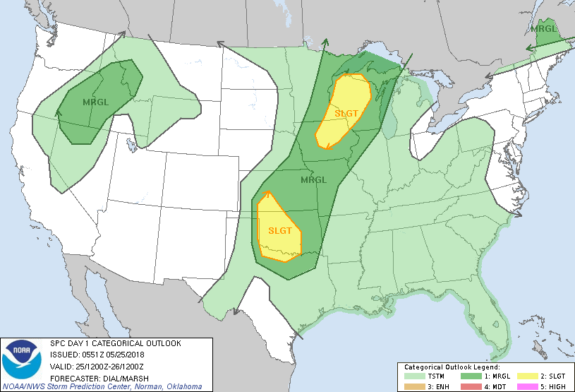
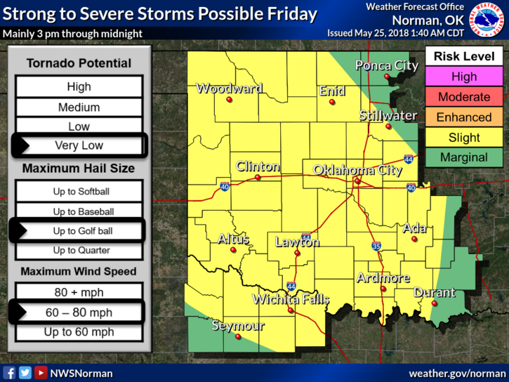
1- WE HAVE BEEN UPGRADED TO A SLIGHT RISK FOR SEVERE WEATHER LATER TODAY. MOSTLY FROM 3PM UNTIL MIDNIGHT TONIGHT. MAIN RISKS ARE 60-80 MPH WINDS AND GOLF BALL SIZE HAIL. THE TORNADO RISK IS VERY LOW BUT NOT OUT OF THE QUESTION.
2- Storms today will be similar to yesterday but a little more intense. If storms form to our NW and then move into the area, they will be similar to the system here in the county right now at 0406L. Basically a Mesoconvective system which is several cells moving together causing rain, wind, hail, and sometimes a lot of damage.
3- Overall, we’ll be ok so just be prepared for possibly some rough weather later today. I’ll send advisories as needed.
4- Here is your forecast from the NWS/NORMAN;
Friday-30 percent chance of showers and thunderstorms. Partly sunny, with a high near 92. South wind 8 to 14 mph, with gusts as high as 20 mph.
Friday Night-Mostly cloudy, then gradually becoming mostly clear, with a low around 67. South wind 6 to 14 mph, with gusts as high as 20 mph.
HAVE A SUPER DAY AND WE’LL ADVISE AS NEEDED.
MIKE