0255L-THURSDAY OUTLOOK FROM GARFIELD COUNTY EMERGENCY MANAGEMENT-11/23/23
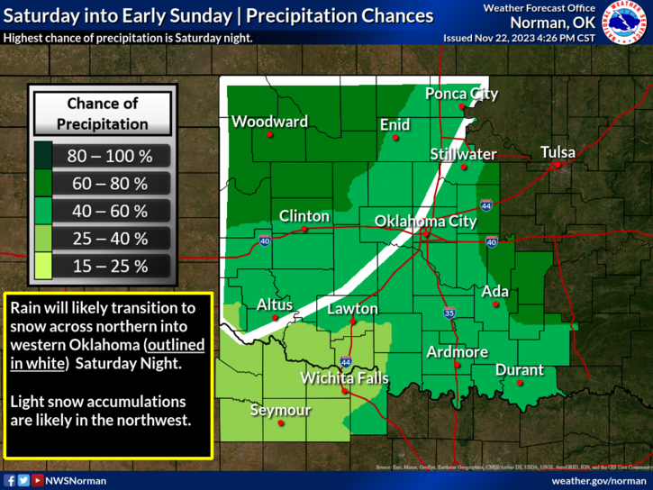
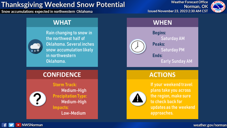
*HAPPY THANKSGIVING EVERYONE! We’ll have a nice day to celebrate and then the bottom starts to drop out. A cold front will traverse the region this afternoon lowering temps for tomorrow into the 40s. Another front with much colder air will move in SATURDAY bringing a chance for some snow. It may start out as rain then transition over to snow. We’ll see how this verifies. See the graphics attached to this post on both the GARFIELD COUNTY EM and the City CONNECT apps, along with the gcem.org website.
*There is no reason to panic over this possible snow event. If you plan on traveling out west or into SW Kansas, keep up with forecast updates with the NWS/DODGE CITY or if you travel into the panhandles, the NWS/AMARILLO. Of course, you can find all sorts of great info from the NWS/NORMAN. Links to all NWS sites are here- https://gcem.org/links/
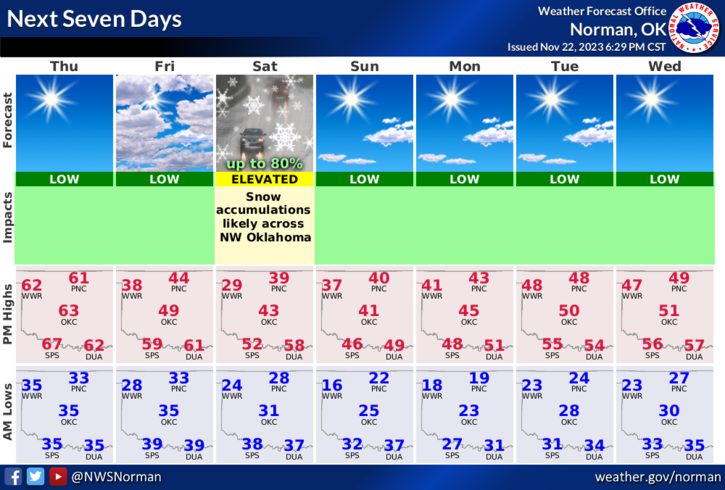
*Overall, we’ll be ok so enjoy the day today but use caution while traveling over the weekend. Here is your forecast from the NWS/NORMAN;
Today- Mostly sunny. Highs in the lower 60s. Southeast winds 5 to 10 mph.
Tonight- Partly cloudy. Cold with lows in the lower 30s. Northeast winds 10 to 15 mph with gusts up to 25 mph.
HAVE A SUPER DAY!