0335L-THURSDAY OUTLOOK FROM GARFIELD COUNTY EMERGENCY MANAGEMENT-10/15/2020
Winter will be here before we know it and are you prepared? You can start that process by downloading our GARFIELD COUNTY EM app. YOU are NOT PREPARED without it!
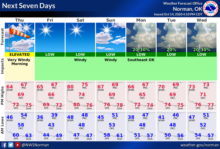
1-The cold front is here and the wind gusts only made it into the 35 mph zone. Winds will slowly subside throughout the day and hopefully the dust settles too. Still, no rain in site and we all know we need it. We are in a Moderate drought per the Drought Monitor and that may change when it gets updated sometime today. We’ll see how that goes.
2- Overall, temps will be cooler and we’ll deal with a few more fronts between now and early next week. Unfortunately, no rain in sight. The Fire Danger will be around now for quite some time. Call 911 if you see smoke or fire. With that, here is your forecast from the NWS/NORMAN;
Today- Mostly sunny. Much cooler. Highs in the upper 60s. North winds 20 to 25 mph decreasing to 10 to 20 mph in the afternoon.
Tonight- Mostly clear. Colder. Lows in the upper 30s. Northeast winds around 10 mph in the evening becoming light and variable.
HAVE A GOOD DAY!
MIKE