0400L-FRIDAY OUTLOOK FROM GARFIELD COUNTY EMERGENCY MANAGEMENT-10/23/2020
1-REMEMBER-GARFIELD COUNTY EM is our notification app. You can get info from us, the NWS, Enid Police, and the Garfield County Sheriff’s Office.
2- The COLD FRONT came ripping through shifting strong southerly winds to the north. They will be gusty but slowly decreasing throughout the day. We may even see the sun as clouds clear out. We will warm up a tough on Saturday and then the bottom falls out and we will be getting a lot colder than what we are used to.
3- As stated yesterday disconnect hoses from the house and make sure your vehicles are winter ready. Don’t want to get surprised by a car not starting. Also, the FIRE DANGER will be higher for a few days due to low humidity and winds so be very careful and report any smoke or fire to 911 so they can dispatch a quick response.
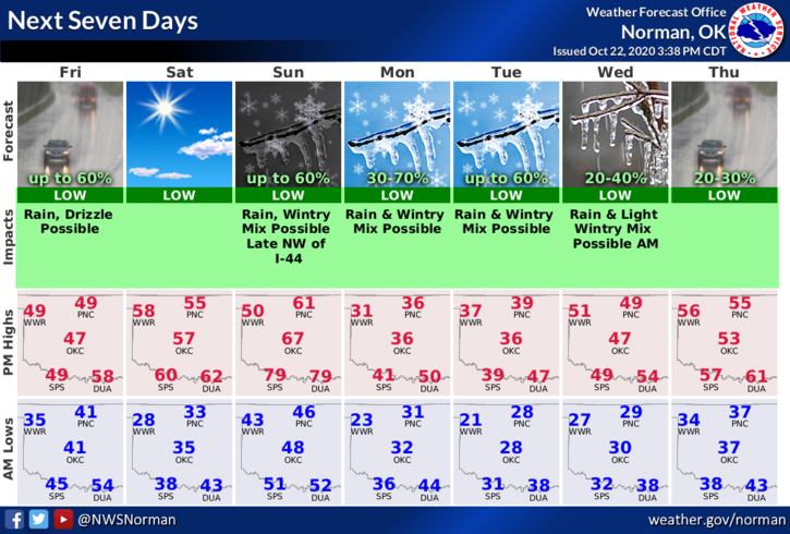
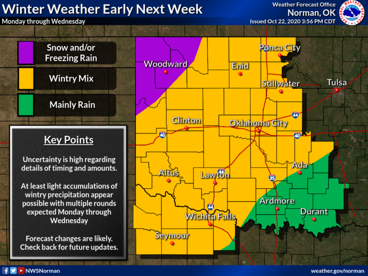
4- Overall, we will be ok, just much colder. We will see a mix of winter weather types starting on Monday so if you need to get out and about, drive according to the conditions. Don’t want anyone to get hurt.
Here is your forecast from the NWS/NORMAN;
Today-Decreasing clouds. Much cooler. Highs around 50. North winds 15 to 25 mph with higher gusts.
Tonight-Clear. Lows around 30. North winds 10 to 15 mph.
HAVE A GOOD DAY!!
MIKE