0425L-SUNDAY OUTLOOK FROM GARFIELD COUNTY EMERGENCY MANAGEMENT-4/18/21
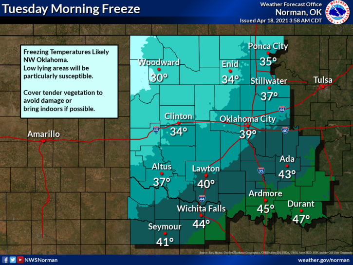
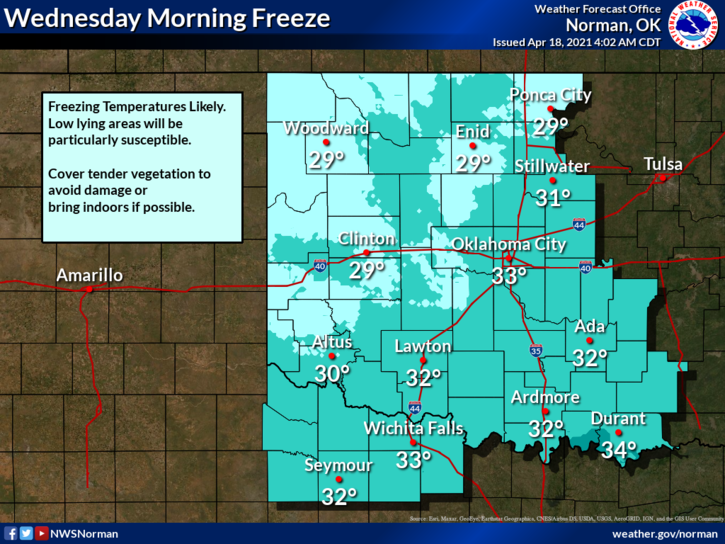
1- FREEZE WATCH IN EFFECT LATE TUESDAY NIGHT THROUGH WEDNESDAY MORNING. Overnight low temps could fall as low as 28 degrees. If you have new plants outdoors, you may want to cover them up. A FREEZE WATCH is also in effect Monday night for counties west of here. Like I have stated, keep a jacket and now maybe a coat in the truck.
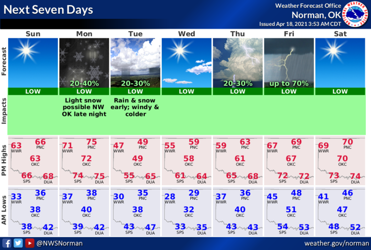
2- The above is due to a cold front that will move through the area on Monday. It will bring colder air from western Canada. Cold air from the north, some moisture return from the south and several troughs moving through the area might bring winter conditions mainly in NW Oklahoma over the next couple of nights. Daytime temps will be well above freezing.
3- REMEMBER: disconnect any hoses connected to your house and protect any new plants you may have put out there. Our biggest threat is the colder air. Overall, we’ll be ok so here is your forecast from the NWS/NORMAN;
Sunday-Patchy frost before 8am. Otherwise, sunny, with a high near 64. Northwest wind 7 to 10 mph.
Sunday Night-Clear, with a low around 37. Northwest wind 5 to 8 mph becoming south southeast in the evening.
FINALLY: Download our GARFIELD COUNTY EM app. You are not prepared without it and you never know, IT JUST MIGHT SAVE YOUR LIFE!!
MIKE