0350L-MONDAY OUTLOOK FROM GARFIELD COUNTY EMERGENCY MANAGEMENT-8/29/22
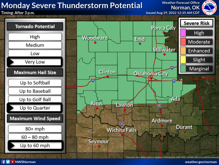
1- MARGINAL RISK for severe weather again later today and tonight. Main threat will be the wind but we could see large hail and torrential rainfall with storms that form later today. Radar indicated rainfall from last night was anywhere from ½ inch to 3 inches in the far southern part of the county. We could see higher amounts later today so be prepared.
2- Overall, we’ll be ok but stay weather aware as the day wears on. We will be very humid once again so pace yourselves while working outdoors. Here is your forecast from the NWS/NORMAN;
Today-Partly sunny with a chance of showers and thunderstorms. Highs in the mid-90s. South winds 10 to 15 mph. Chance of rain 50 percent.
Tonight-Mostly cloudy with a chance of showers and thunderstorms. Humid with lows in the upper 60s. South winds 5 to 10 mph with gusts up to 20 mph, becoming northwest after midnight. Chance of rain 40 percent.
HAVE A GOOD DAY!