0300L-MONDAY OUTLOOK FROM GARFIELD COUNTY EMERGENCY MANAGEMENT-12/12/22
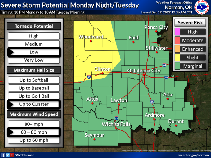
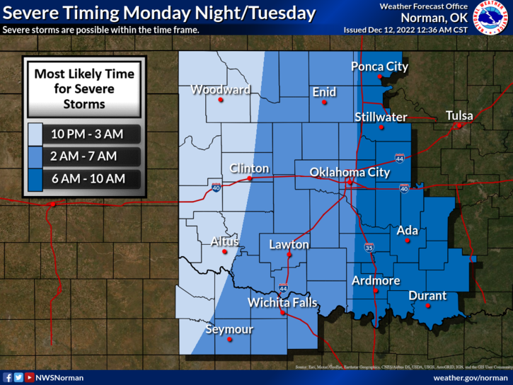
1- We are in a MARGINAL RISK for severe weather later this evening and overnight. The graphs attached are an idea for risk areas. THESE WILL CHANGE SOME DURING THE DAY so don’t get fixated on where these lines are now. We have a Pacific front coming and it will start to affect the area overnight. Risks will be strong winds, heavy rainfall, and a very low chance for isolated tornadoes. Depending whether storms come in discreetly or in a QLCS scenario will depend on what we will keep an eye out for. Well update later today as needed. Make sure you have our GARFIELD COUNTY EM APP DOWNLOADED. You just may need it tonight.
KEEP THIS LINK HANDY— https://www.weather.gov/oun/
2- We are in an EXTREME DROUGHT. Just be careful utilizing anything related to fire. Call 580-234-FIRE (3473) for controlled Burns
3- Overall, we’ll be ok so here is your forecast from the NWS/NORMAN;
Today- Cloudy. Areas of dense fog this morning. A chance of drizzle this morning, then a chance of rain this afternoon. Highs in the mid-50s. Southeast winds 15 to 20 mph with gusts up to 30 mph. Chance of rain 30 percent.
Tonight- Showers with a slight chance of thunderstorms in the evening, then showers with a chance of thunderstorms after midnight. Locally heavy rainfall possible after midnight. Near steady temperature in the lower 50s. Southeast winds 15 to 20 mph with gusts up to 30 mph. Chance of rain near 100 percent.
HAVE A GOOD DAY