0300L-MONDAY OUTLOOK FROM GARFIELD COUNTY EMERGENCY MANAGEMENT-12/27/21
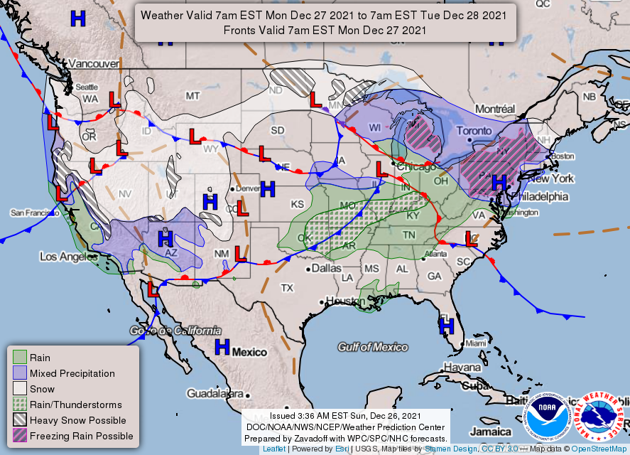
1- A cool front moved through overnight. No rain, just a wind shift. Another one will push through later Tuesday evening bringing colder air and strong northerly winds with it. There will be a small possibility of some rain overnight but it looks so-so right now. The big change in temps looks to be on New Years day when we may have highs in the mid to upper 30s.
2- For those that want winter weather, some areas in North Dakota are under a Winter Storm Warning. Some snow totals are near 6.5 inches. Unfortunately, that’s not moving our way. All I can say is enjoy our warmer weather for now, IT WILL CHANGE SOON!
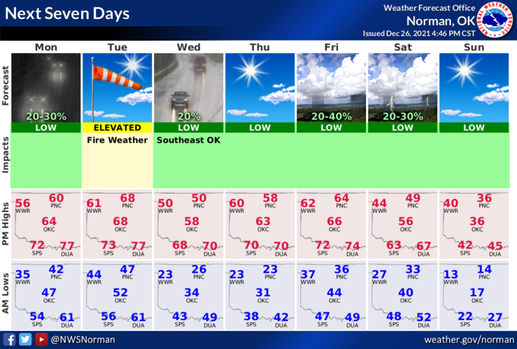
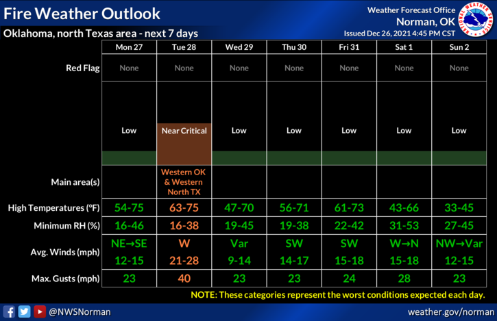
3- We remain dry so keep an eye out for smoke and call 911 so a quick response can be sent. Overall, we’ll be ok so enjoy the day! Here is your forecast from the NWS/NORMAN;
Today-Mostly sunny. Cooler. Highs around 60. North winds around 10 mph shifting to the east in the afternoon.
Tonight-Mostly cloudy. A slight chance of rain after midnight. Lows in the mid-40s. Southeast winds around 10 mph shifting to the south after midnight. Chance of rain 20 percent.
STAY SAFE AND HAVE A GOOD DAY!
MIKE