SUNDAY OUTLOOK FROM GARFIELD COUNTY EMERGENCY MANAGEMENT-12/26/21
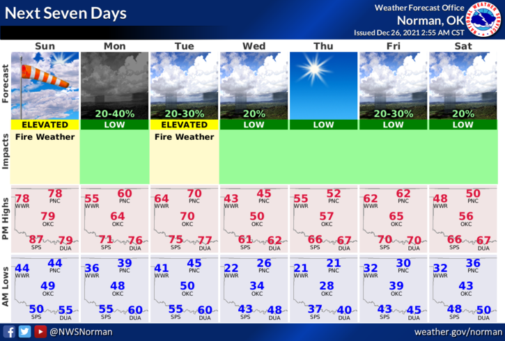
1-More of the same with warm temps, windy conditions, and an occasional front pushing in. A cold front Monday night will cool things down some but we’ll rebound fairly quickly. There is a chance for a substantial cold front by the weekend but all models aren’t on board yet. We’ll see what happens as we get closer to the end of this year.
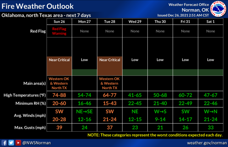
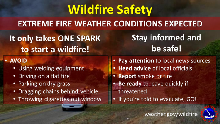
2- There is a Red Flag Fire Warning forecast for the western 2 tiers of counties so if you are traveling, stay aware of fire conditions out there too. If you see smoke or fire here or out there, call 911. Here is your forecast from the NWS/NORMAN;
Today-Increasing clouds. Warmer. Highs in the upper 70s. South winds 10 to 20 mph with higher gusts.
Tonight-Partly cloudy. Lows in the upper 30s. Southwest winds 10 to 20 mph shifting to the northwest 10 to 15 mph after midnight with higher gusts.
HAVE A GOOD DAY!