0335L-TUESDAY OUTLOOK FROM ENID/GARFIELD COUNTY EMERGENCY MANAGEMENT-12/28/21
DANGEROUSLY COLD TEMPS THIS WEEKEND ARE FORECAST.
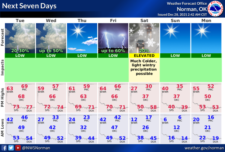
1- I posted a short message on social media yesterday concerning the weather towards and on this weekend. I stated the word BRUTAL. Take this to heart as high temps through Friday will be in the 50s and 60s. SATURDAY WE DROP INTO THE 20S FOR HIGHS, INTO THE SINGLE DIGITS OVERNIGHT WITH WINDCHILL TEMPS EARLY SUNDAY DOWN TO -9 DEGREES BELOW ZERO. This is a dangerous drop in temps when we have enjoyed very mild temps for this time of year. There is a slight chance, per guidance, that we could see some winter precip of some sort too. Either way, be prepared for the temperature difference.
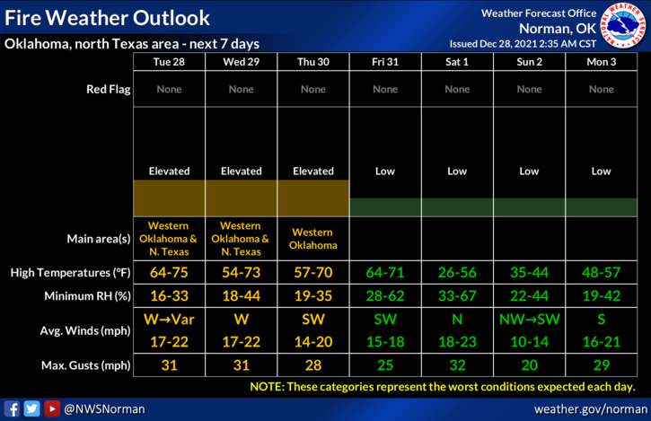
2- Enough preaching for now. The FIRE DANGER will be elevated so check forecasts for wind information before setting any controlled burn. Call 911 if you see smoke or fire. A list of Fire Department Number can be found here- https://gcem.org/emergency-numbers/ Here is your forecast from the NWS/NORMAN;
Today-Mostly cloudy with a slight chance of thunderstorms early in the morning, then sunny in the late morning and afternoon. Highs in the upper 60s. West winds 10 to 20 mph. Chance of thunderstorms 20 percent.
Tonight-Mostly clear. Colder. Lows in the upper 20s. Northeast winds around 10 mph.
HAVE A GOOD DAY!
MIKE