FROM GARFIELD COUNTY EMERGENCY MANAGEMENT
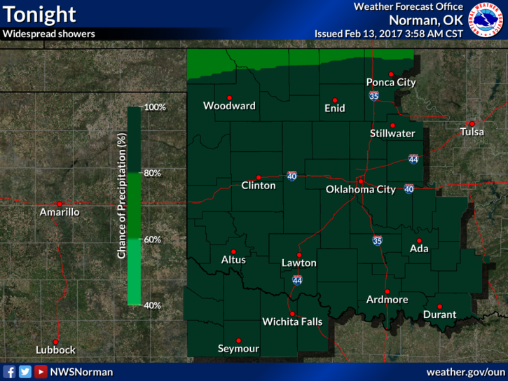
The last several days have brought a large variance of conditions. We have enjoyed some summer temps along with strong winds, then lighter winds, and then a cold front spoils that and cools us off. Rain is in the forecast and hopefully we will receive some later today into the overnight hours. It does look bleak for any winter precip but there may be a flurry or two overnight tonight if temps get low enough. Other than that, any moisture at this point is a good thing.
The FIRE DANGER is still with us along with the fact that we are in a BURN BAN until February 24th. It wouldn’t surprise me that the Governor extends this until we either receive substantial rainfall or things start to green up. Either way be careful out there and continue to report any smoke or fire that you see. Also, keep a close eye out for suspicious activity since there are folks out there that enjoy starting fires.
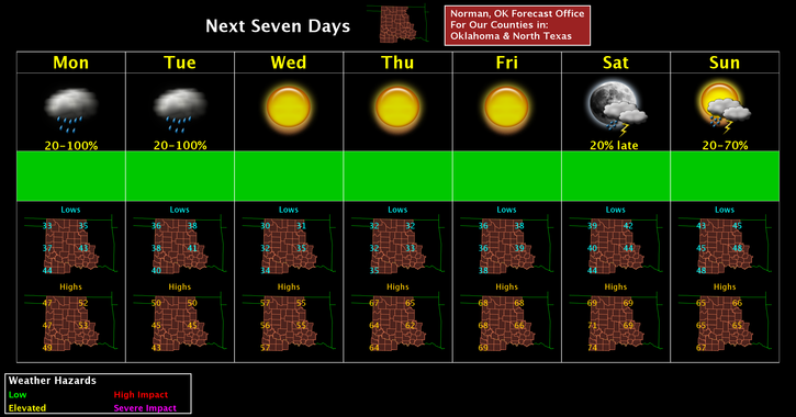
Here is your forecast from the NWS/NORMAN;
Monday-A 30 percent chance of showers after noon. Cloudy, with a high near 52. Northeast wind 5 to 8 mph becoming south in the afternoon.
Monday Night-Showers. Low around 34. North wind around 6 mph. Chance of precipitation is 80%. New precipitation amounts between a quarter and half of an inch possible.
Have a super day!!
MIKE