0305L-MONDAY OUTLOOK FROM GARFIELD COUNTY EMERGENCY MANAGEMENT-2/14/22
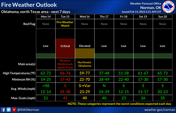
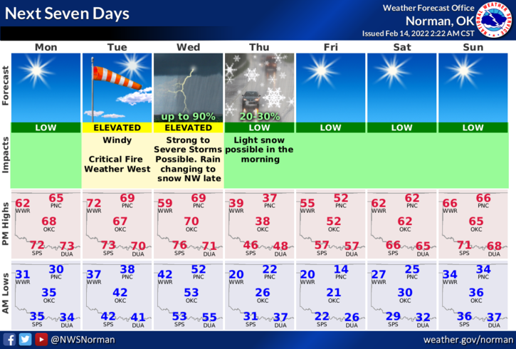
1- TODAY will be the nicest day of the week until Friday. Tuesday = wind & fire weather, Wednesday = possible rain/snow mix late, Thursday = light rain/snow early but cold all day and windy. This mess might change but right now, this is the way it could occur. See the fire weather and next 7 days graphics attached.
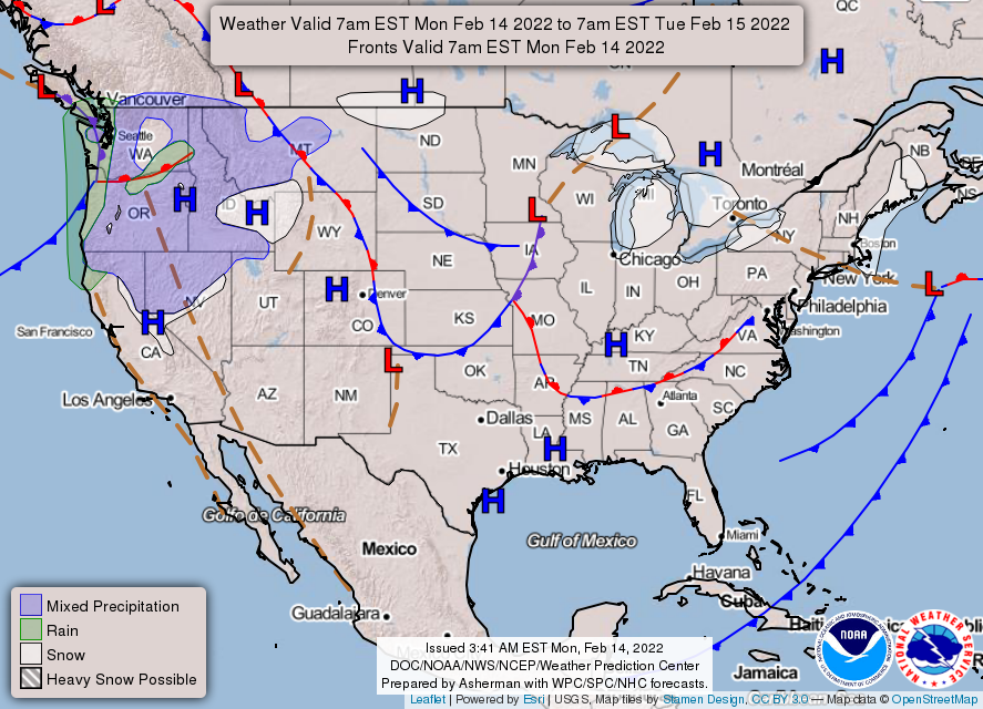
2- There is a weak front that MIGHT make it here this morning but it should wash out as it does. A wind shift might occur for a few hours then transition from northerly switching from the east. We may see highs today into the mid to upper 60s.
3- OVERALL, not too bad then its downhill for a few days. Here is your forecast from the NWS/NORMAN;
Today-Sunny, warmer. Highs in the mid-60s. West winds around 10 mph shifting to the east in the afternoon.
Tonight-Clear. Lows in the upper 30s. Southeast winds 10 to 15 mph with higher gusts.
Finally, I have placed a new survey for our HAZARD MITIGATION PLAN on our gcem.org website. If you live in the county and would like to take part in the plan, the links are on the website. Please take all 3 if you haven’t taken any in the past. This really helps us in determining what the people want in the plan. We are updating the plan but can add to projects or whatever depending on your answers. When our website comes up, all 3 links will be right in front of you. Thank you for helping us here.
HAVE A GOOD DAY!!