0315L-SUNDAY OUTLOOK FROM GARFIELD COUNTY EMERGENCY MANAGEMENT-2/13/22
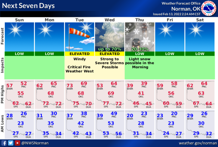
1- Sunny with a weak front that should push into the area early this morning shifting southerly winds back to the north. We actually will be warmer today but winds around 10 mph may make it seem a little cooler. Winds will transition back to the southeast later this evening and another weak front pushes in Monday morning.
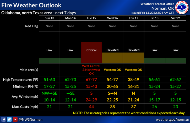
2- Winter is trying to tell us that she isn’t done with us yet so be prepared at all times! 😊 By mid-week we’ll most likely see some showers and thunderstorms but the severe risk appears that it will be south of us. Personally, I am not worried about severe right now, we just need the water. This said, the FIRE DANGER remains elevated and it will become CRITICAL ON Tuesday. Keep an eye out for smoke and fire and call 911 if you see any. A quick response from you to call 911 allows a quick response from us.
3- Overall, we’ll be ok. Here is your forecast from the NWS/NORMAN;
Today-Sunny. Not as cool. Highs in the mid-50s. Northwest winds 10 to 15 mph.
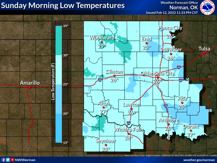
Tonight-Clear. Lows in the lower 30s. South winds around 10 mph.
HAVE A GOOD DAY!