0355L-MONDAY EXTREMELY COLD OUTLOOK FROM GARFIELD COUNTY EMERGENCY MANAGEMENT-2/15/21
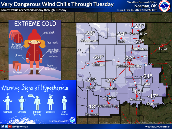
1- WIND CHILL WARNING in effect now until Tuesday morning at 12 noon. Right now, at 0320 local time, we are at -6 below zero with a wind chill of -32 degrees below zero. If you have to be out, USE EXTREME CAUTION.
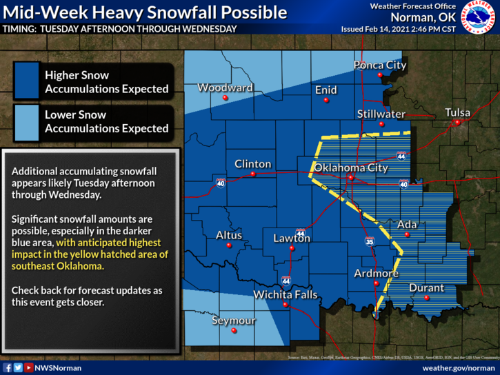
2- WINTER STORM WATCH from Tuesday afternoon through Wednesday evening. We aren’t in the Winter Storm Warning area for tomorrow YET but may be depending on the actual storm track. We still look to receive another 3-6 inches of snow for this whole event.
3- I measured 5.75-6 inches of snow yesterday and that was difficult since open areas were snow blown. We may have had more which I am sure was possible but our area will receive more today and during this week. There are some good drifts out there. We’ll see what happens.
4- The main danger that EVERYONE needs to keep in mind is the WIND CHILL. Minus 32 degrees right now and it won’t improve too much during the day. Use extreme caution if you have to be outside. Roads around the area are mostly snowpacked and where they have cleared the roads may be icy. I was out for a little while yesterday and people need to SLOW DOWN. You hit an ice patch out there you could lose control. Just be careful.
5-Finally, check on outdoor animals, your neighbors, and cover your skin if you plan on being outside today. Here is your forecast from the NWS/NORMAN;
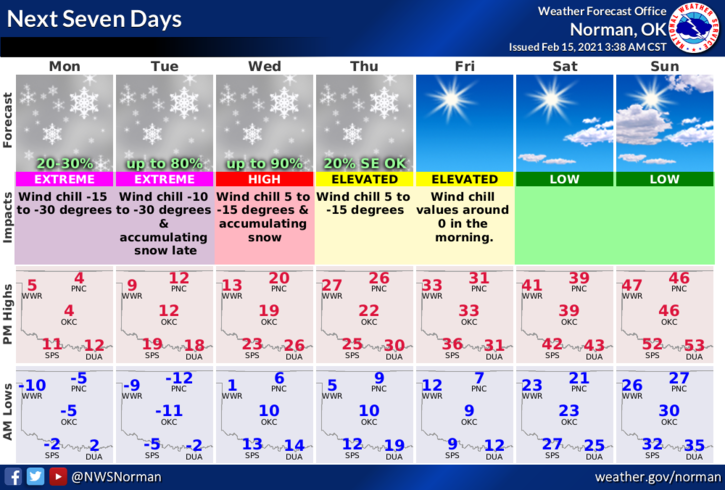
TODAY- 20 percent chance of snow before noon. Areas of blowing snow before noon. Mostly cloudy and cold, with a high near 4. Wind chill values as low as -27. North wind 8 to 13 mph.
TONIGHT- Partly cloudy, with a low around -13 below zero. Wind chill values as low as -24. North wind around 6 mph becoming light and variable. I will update these graphics later.
STAY IN, STAY SAFE, STAY WARM,
MIKE