0325L-MONDAY OUTLOOK FROM GARFIELD COUNTY EMERGENCY MANAGEMENT 02/26/24
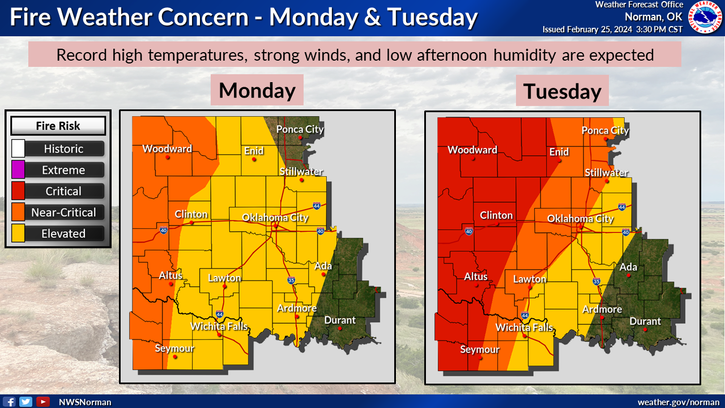
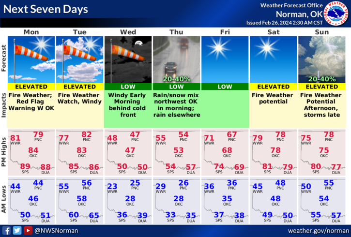
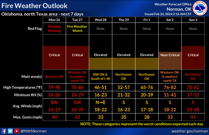
*FIRE WEATHER has taken over since humidity will be very low, winds will be fairly high, and temps will be around the 80 degree mark. A Fire Weather Watch is in effect from TUESDAY morning through Tuesday evening. The danger today is ELEVATED but tomorrow could end up being a rough day in the CRITICAL ZONE. Tuesday night, we’ll have a strong cold front move in dropping temps into the 20’s with wind chill temps in the low teens. Winds will calm down some late Wednesday but increase out of the south on Thursday, becoming gusty again around 15-25 mph. It won’t take much for anything you deem controlled to become out of control in the expected winds, especially on Tuesday.
*Overall, we’ll be ok so if you see smoke or fire, call 911. Here is your forecast from the NWS/NORMAN;
Today- Mostly sunny. Highs in the lower 80s. West winds 15 to 20 mph.
Tonight- Mostly cloudy in the evening, then becoming partly cloudy. Lows in the upper 50s. Southwest winds 15 to 20 mph with gusts up to 30 mph, diminishing to 5 to 10 mph with gusts up to 20 mph after midnight.
*FINALLY, an update is coming to several channels on the GARFIELD COUNTY EM app. When the update occurs, I’ll make known what the codes are for the protected channels to the respective emergency services folks. There won’t be changes for the public at this time.
HAVE A GOOD DAY!