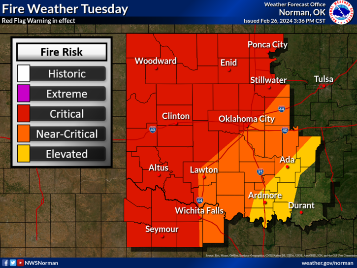
0325L-TUESDAY OUTLOOK FROM GARFIELD COUNTY EMERGENCY MANAGEMENT 02/27/24
*RED FLAG FIRE WARNING IN EFFECT FROM 11AM UNTIL 8PM THIS EVENING- Winds-25-35 MPH gusting to 55 MPH, Humidity-as low as 17%, Temps- into the Mid-80’s. WX conditions are Critical today. There is also a WIND ADVISORY in effect from 9 am this morning until midnight tonight. IF YOU SEE SMOKE OR FIRE, CALL 911.
*Due to the warning today, we ask that there be NO CONTROLLED BURNING. Burning in an environment as we will have today is extremely dangerous.
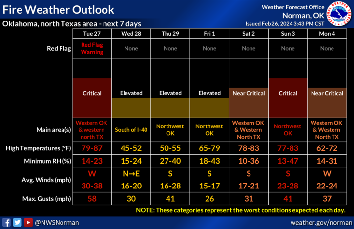
*WSW winds will give way to a cold front later today with gusty NNW sustained winds at 36mph gusting to 54 mph. If there are ongoing fires, this wind-shift could be very dangerous. Timing is anytime between 3-6pm this evening, per guidance. Winds should lay down after midnight tonight. Temps will end up in the mid-20s or so.
*Other than the above, we should see sunny skies probably with a lot of smoke and dirt in the air. This said, here is your forecast from the NWS/NORMAN;
Today- Mostly sunny and very windy. Highs in the lower 80s. Southwest winds 25 to 35 mph with gusts up to 50 mph.
Tonight- Partly cloudy in the evening, then clearing. Very windy and much colder with lows in the mid-20s. Northwest winds 25 to 35 mph with gusts up to 55 mph, becoming north 15 to 25 mph with gusts up to 35 mph after midnight.
HAVE A GOOD DAY!