0335L-MONDAY OUTLOOK & INFO FROM GARFIELD COUNTY EMERGENCY MGMT-2/3/20
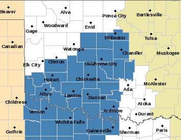
A WINTER STORM WATCH IS IN EFFECT FROM 6PM TUESDAY UNTIL WEDNESDAY AT 6PM. We are not in this at this time. See the first graphic for counties in the watch.
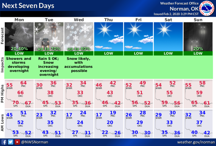
1- Are you ready for some cold weather now? A cold front will push through the area this afternoon and temps will slowly fall. Low temps tonight and highs tomorrow will be around 30 degrees. The wind chill will be the dangerous factor later on Tuesday, so make sure you wear the proper clothing if you have to be outside.
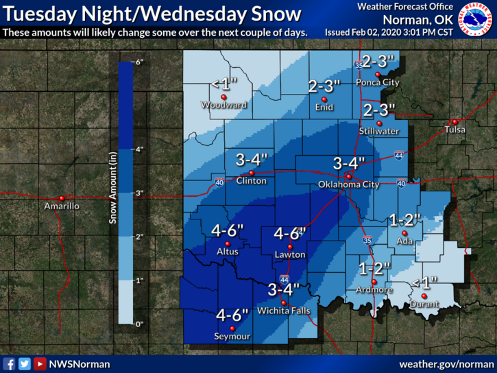
2- As for snow and amounts, some models are in agreement and some aren’t yet. The storm system is still 36 hours out so where graphics are showing possible totals, THESE MAY CHANGE. Overall, Later Tuesday and Wednesday may not be good travel days especially west-southwest and possibly into OKC. We’ll see how this mess comes together for sure.
3- Overall, we will survive this and we may see some winter precip. IF WE DO, slow down while driving, put your cell phones down too, and just take your time especially on elevated surfaces.
4- Here is your forecast from the NWS/NORMAN;
Monday-Partly sunny with a high near 63. South southwest wind 15 to 20 mph becoming north in the afternoon. Winds could gust as high as 25 mph.
Monday Night-Mostly cloudy with a low around 30. North wind 15 to 20 mph, with gusts as high as 25 mph.
HAVE A GOOD DAY!!
MIKE