0310L-TUESDAY OUTLOOK FROM GARFIELD COUNTY EMERGENCY MANAGEMENT 01/16/24
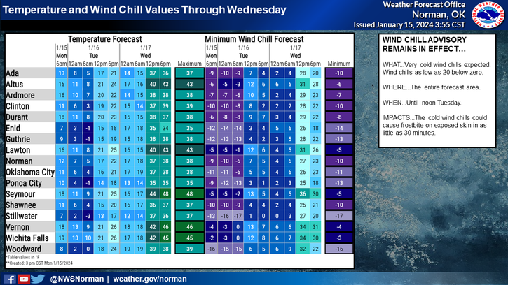
** A WIND CHILL ADVISORY WILL BE IN EFFECT UNTIL NOON TODAY.
*We are forecast to get up to the mid to upper teens to low 20’s this afternoon but we’ll climb up into the low to mid 30’s on Wednesday. Wind chill-wise, we’ll continue to be cold with those temps still in the single digits today into early Wednesday. By noon tomorrow, our wind chill temps SHOULD rise into the 20’s. All we can do at this point is continue to break in those heavier coats we bought several years ago. 😊
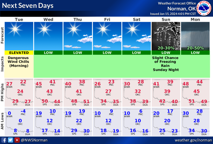
*We’ll have yet another front push in on Thursday so the weekend looks be cold once again but not as cold as this one was. We’ll see.
*Overall, we’ll be ok so here is your forecast from the NWS/NORMAN;
Today- Sunny, cold with highs in the mid-20s. West winds 5 to 10 mph, becoming southwest this afternoon. Wind chill values as low as 16 below this morning.
Tonight- Clear. Not as cold with lows around 15. South winds 10 to 15 mph.
STAY WARM AND HAVE A GREAT DAY!