0255L-MONDAY OUTLOOK FROM GARFIELD COUNTY EMERGENCY MANAGEMENT 01/22/24
*The Winter Weather Advisory was canceled for our area at 0215 local time. This doesn’t mean we won’t see any precip, it only means that we shouldn’t see enough precip to warrant any advisories or warnings. We are at 31 degrees, right now so keep an eye out on bridges and overpasses for possible ice. That said, we will probably see some rain today but we’ll be above freezing so we aren’t expecting any freezing stuff today or tonight. Believe it or not, Monday night’s low should remain in the mid-30s.
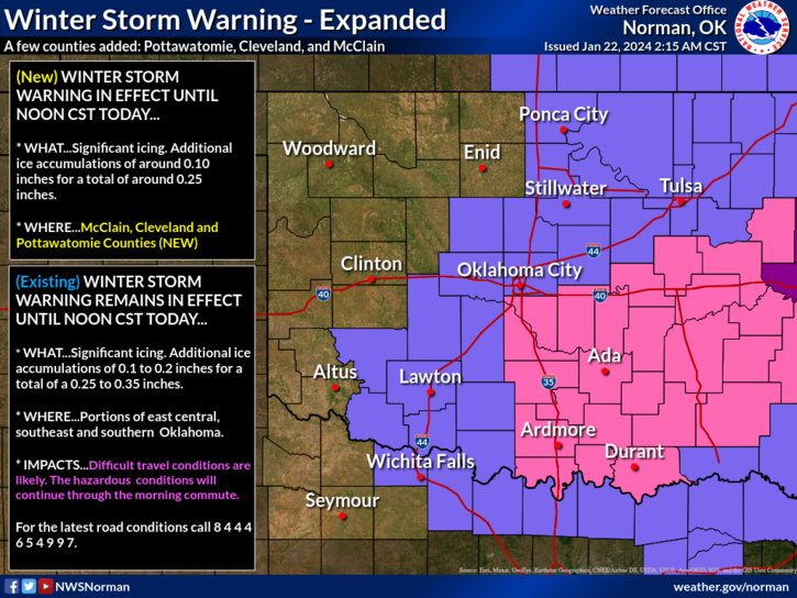
*If you’re planning to drive south and east today, I would wait until temps rise above freezing. Looking at the graphic I posted earlier, there are areas that are heavily iced over and driving will be very hazardous. If you leave, just be careful.
*Overall, we’ll be ok here, so here is your forecast from the NWS/NORMAN;
Today- Cloudy. A slight chance of drizzle and freezing drizzle this morning, then rain likely this afternoon. Patchy fog. Ice accumulation around a trace. Highs in the mid-30s. Southeast winds 10 to 15 mph. Chance of precipitation 70 percent.
Tonight- Cloudy. A chance of rain in the evening. Patchy fog. Near steady temperature in the mid-30s. Southeast winds around 5 mph. Chance of rain 50 percent.
STAY WARM AND HAVE A GOOD DAY!