0255L-TUESDAY OUTLOOK FROM GARFIELD COUNTY EMERGENCY MANAGEMENT 01/23/24
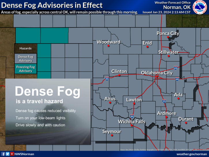
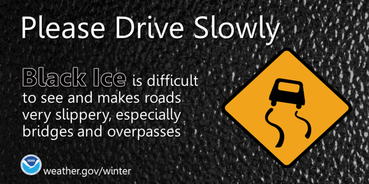
*DENSE FOG ADVISORY IN EFFECT UNTIL 10 AM THIS MORNING. ALSO, AT 0240 WE ARE AT 32 DEGREES AND THE GROUND IS WET. USE EXTREME CAUTION WHILE DRIVING, ESPECIALLY ON BRIDGES AND OVERPASSES.
*Cloudy will be a term we use a lot this week and we’ll remain wet out there. At 0245 its very foggy and visibility is roughly 200-300 feet. We are at 32.5 degrees so bridges and overpasses “might” be slick so if you plan on driving early, use extreme caution. By the way, we are in a FOG ADVISORY and this is in effect for virtually the whole state.
*Not too much else to discuss right now but overall, we’ll be ok so here’s your forecast from the NWS/NORMAN;
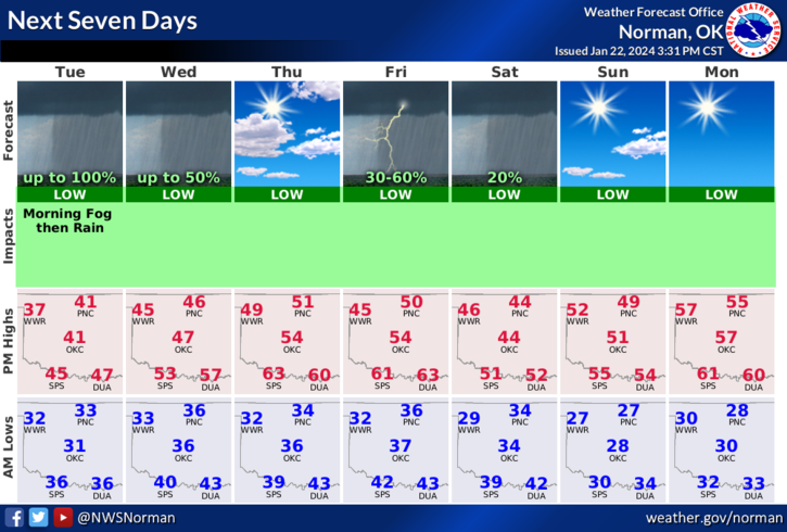
Today- Cloudy. Patchy drizzle this morning, then rain showers likely this afternoon. Areas of dense fog this morning, then patchy fog this afternoon. Highs around 40. Northeast winds around 5 mph. Chance of rain 70 percent.
Tonight- Cloudy. Rain showers, mainly in the evening. Near steady temperature in the upper 30s. North winds 5 to 10 mph. Chance of rain 80 percent.
**STORM SEASON is just around the corner. This is the time many get really scared. No reason to be. I will be talking about this in detail as we move further into the late winter and Spring.
HAVE A GOOD DAY!