0245L-MONDAY OUTLOOK FROM GARFIELD COUNTY EMERGENCY MANAGEMENT-6/26/23
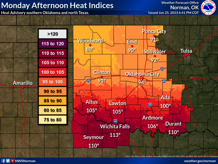
*We had a front push through yesterday keeping us cooler for the day compared to the higher heat indices we had on SATURDAY. Not complaining here! We’ll be about the same today as we were on Sunday and then the toaster gets turned and temps will go up through the rest of the week. IF you plan in traveling south into southern Oklahoma or North Texas, the heat index down there will be well over 100 so use extreme caution while in that vicinity. The atmosphere down there will be very oppressive so be careful.
*As stated above after the passage of yesterday’s front, enjoy today with lower humidity and near average temps. We should reach the 100’s around mid-week or so. Welcome to summer!
*Overall, we’ll be ok so here is your forecast from the NWS/NORMAN;
Monday-Sunny. Highs in the lower 90s. East winds 5 to 10 mph.
Monday Night-Mostly clear in the evening, then becoming partly cloudy. Lows around 70. East winds 5 to 10 mph.
*Be sure to download our GARFIELD COUNTY EM app. You’re not prepared without it!
HAVE A GOOD DAY!