0310L-TUESDAY OUTLOOK FROM GARFIELD COUNTY EMERGENCY MANAGEMENT-6/27/23
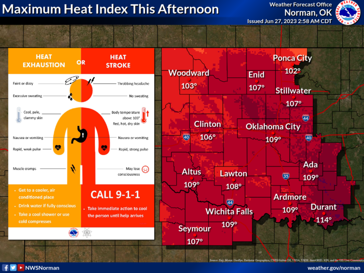
*HEAT ADVISORY IS IN EFFECT FROM 1300L-(1PM) UNTIL 2000L-(8PM) TONIGHT- DANGEROUS HEAT INDEX TEMPS UPWARDS TO 108 EXPECTED LATER TODAY.
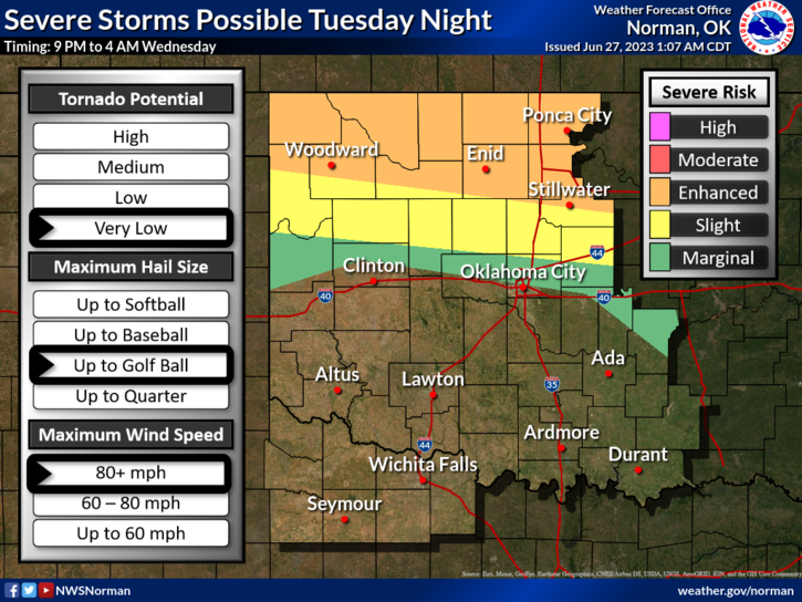
*ENHANCED RISK FOR SEVERE WEATHER DURING THE EVENING HOURS. WINDS IN EXCESS OF 75 MPH IS THE MAIN THREAT. Golf ball size hail is the second threat and the tornado threat is very low at this time. See graphics attached for timing, etc.
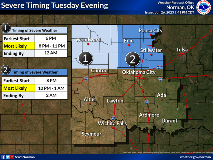
Today is the transition day from rather nice weather to someone turned on the furnace weather. It comes with that threat for severe weather too. Storms will fire out west and congeal into a Meso-convective system and roll through our area sometime in the 10pm to 1 am timeframe. It could be earlier or later and I am sure some of these details will change during the day. Make sure you have our GARFIELD COUNTY EM app and keep up with NWS ADVISORIES AND WARNINGS.
Overall, we’ll be ok but it will be very hot. Use extreme caution if working outdoors. Here is your forecast from the NWS/NORMAN;
Today- Mostly sunny. Highs in the upper-90s. Southeast winds 10 to 15 mph with gusts up to 25 mph. Heat index values up to 108 this afternoon.
Tonight- Partly cloudy. A chance of showers and thunderstorms, mainly in the evening. Humid with lows in the lower 70s. East winds 10 to 15 mph with gusts up to 25 mph. Chance of rain 40 percent. Heat index values up to 108 early in the evening.
HAVE A GOOD DAY AND WE’LL KEEP YOU ADVISED.