0400L-MONDAY OUTLOOK FROM GARFIELD COUNTY EMERGENCY MANAGEMENT-5/27/19
1-SEVERE THUNDERSTORM WATCH UNTIL 0500L AND WE ARE UNDER A FLOOD WARNING UNTIL 1330L THIS AFTERNOON.
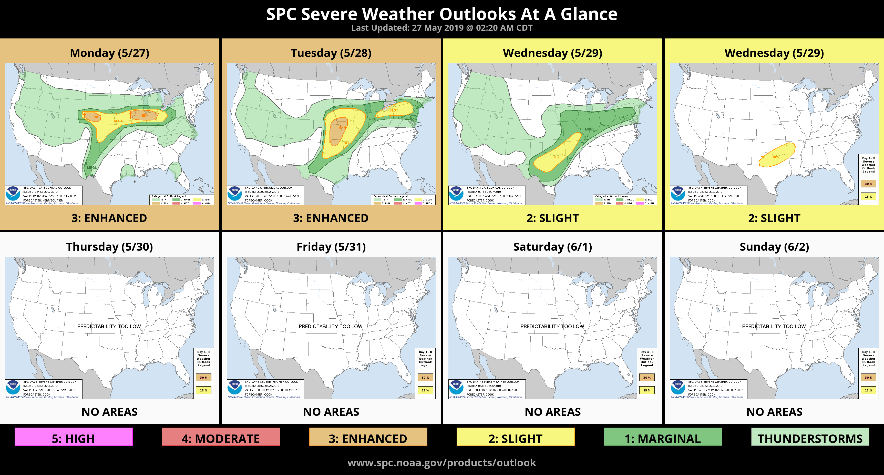
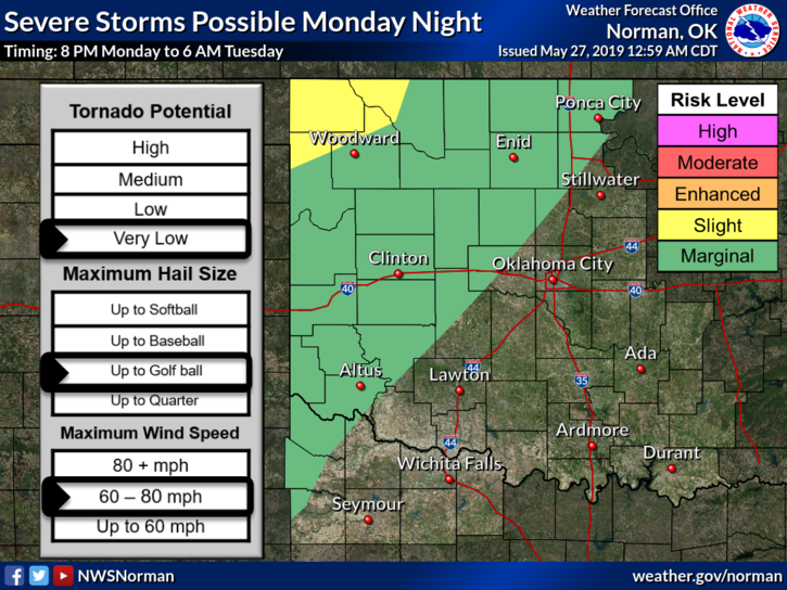
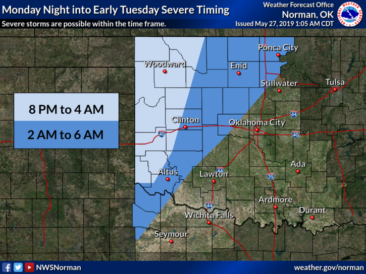
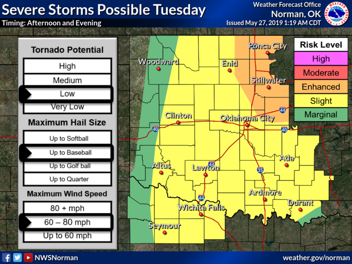
2- We didn’t catch the brunt of that line I spoke about last night and I am not complaining. At 0315L Severe weather is ongoing in the Woodward/Freedom area and those storms are moving NE at 45mph. We are watching for any back-building of storms that could affect us early this morning as that line moves off to the northeast. This said, we are in a MARGINAL RISK for thunderstorms today. See and read the graphics attached, carefully. These will change some throughout the day.
3- Overall, we should be ok. That said, here is your forecast from the NWS/NORMAN;
Memorial Day-Showers and thunderstorms, mainly before 7am. Some of the storms could produce heavy rainfall. High near 82. South wind 10 to 20 mph, with gusts as high as 25 mph. Chance of precipitation is 80%. New precipitation amounts of less than a tenth of an inch, except higher amounts possible in thunderstorms.
Monday Night-20 percent chance of showers and thunderstorms after 1am. Partly cloudy, with a low around 66. South wind 10 to 15 mph, with gusts as high as 20 mph.
4- Finally, there is a photo drifting around on social media showing a lowering southeast of the Police Department, “allegedly” Saturday night. Many folks have claimed this picture as theirs. If you took this picture, “contact me directly” as I need to VERIFY the timestamp on your phone per the correct date, time, and location it was taken. Email me at mike@gcem.org and arrangements will be made for verification. Thank you.
HAVE A GOOD DAY!!
MIKE