0415L-TUESDAY OUTLOOK FROM GARFIELD COUNTY EMERGENCY MANAGEMENT-5/28/19
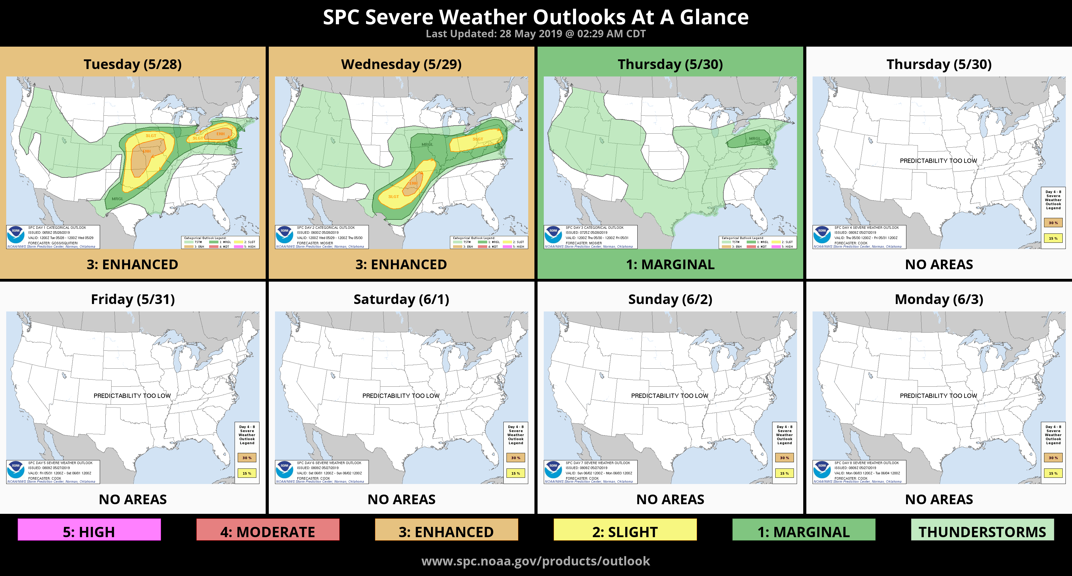
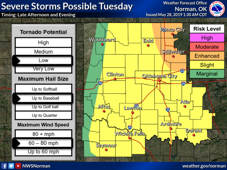
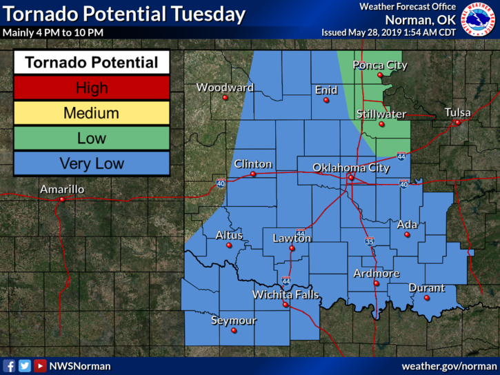
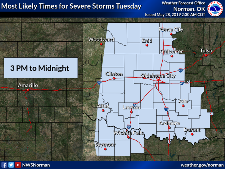
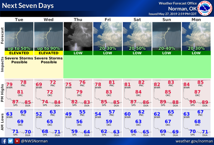
1- SLIGHT/ ENHANCED RISK FOR SEVERE WEATHER LATER THIS AFTERNOON INTO TONIGHT. ALL HAZARDS MAY BE POSSIBLE. SEE ATTACHED GRAPHICS.
2- Road conditions can be found here on the front page- gcem.org
3- Our app-GARFIELD COUNTY EM = LOCAL INFO from our office along with push notifications directly from the NWS/NORMAN.
4- Here is your countywide forecast from the NWS/NORMAN;
Tuesday- Mostly cloudy. A slight chance of thunderstorms in the morning then scattered thunderstorms in the afternoon. Highs in the lower 80s with south winds 15 to 20 mph. Chance of thunderstorms 50 percent.
Tuesday Night-Mostly clear. Isolated thunderstorms in the evening. Cooler. Lows around 60. South winds 10 to 15 mph. Chance of thunderstorms 20 percent.
HAVE A GOOD DAY
MIKE