0400L-SATURDAY OUTLOOK FROM GARFIELD COUNTY EMERGENCY MANAGEMENT-4/24/21
1- It rained and according to our gauges, we received 1.5 inches of rainfall. Some of that came in about 10-15 minutes as a downburst occurred late yesterday afternoon. That was rainfall that no matter how fast or slow you were, you would look like you climbed out of a pool when it was over. Remember Gary England? To him this would have been considered a Toad Strangler. 😊
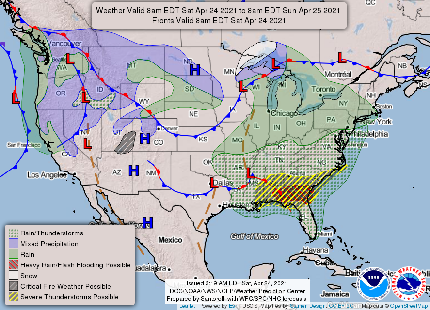
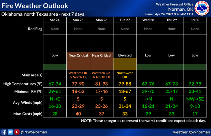
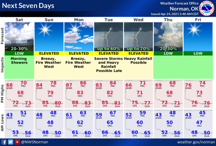
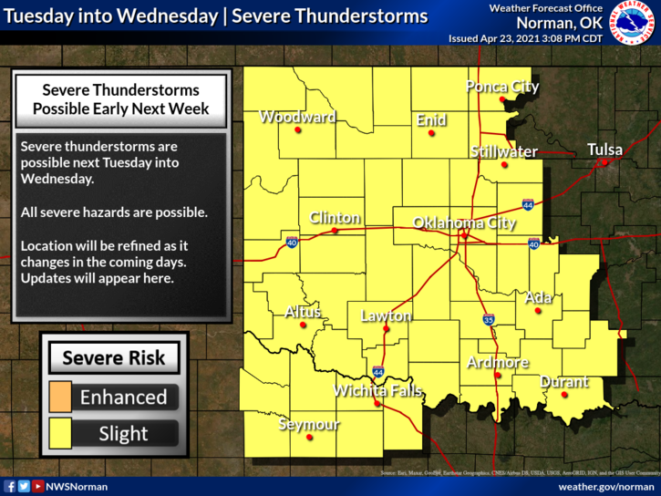
2-Clearing will occur today but the winds will be increasing so be prepared for that. Fire weather conditions will increase Sunday through Tuesday when another storm system arrives. Tuesday looks like it could be interesting severe-wise but where it will actually track is still in question. As that guidance comes together, we’ll post it for you. Don’t let the panic on TV overwhelm you. Take a deep breath, let it out, and enjoy the storms.
3- Overall, we’ll be ok and make sure you download our GARFIELD COUNTY EM app. NWS advisories and warnings come through it automatically. You never know, besides helping you be prepared, it just MIGHT SAVE YOUR LIFE!
4- Here is your forecast from the NWS/NORMAN;
Today-Mostly cloudy with a slight chance of rain early in the morning, then mostly sunny in the late morning and afternoon. Highs in the upper 60s. North winds 10 to 15 mph gusting to 25 mph. Chance of rain 20 percent.
Tonight-Clear. Lows in the mid-40s. Southeast winds 10 to 15 mph.
HAVE A GOOD DAY!
MIKE