0350L-SUNDAY OUTLOOK FROM GARFIELD COUNTY EMERGENCY MANAGEMENT-4/25/21
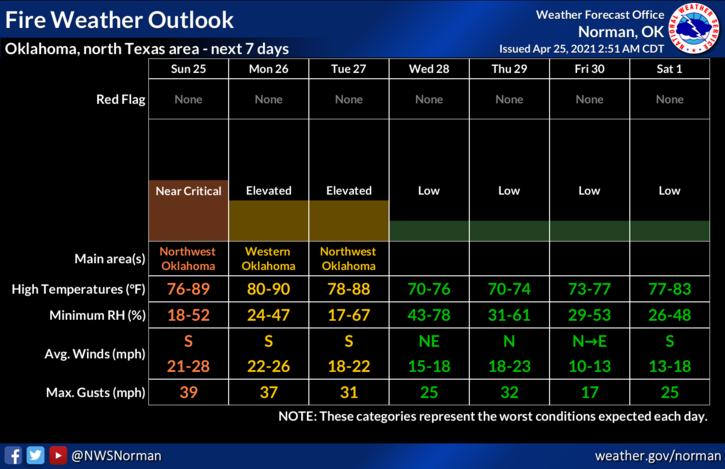
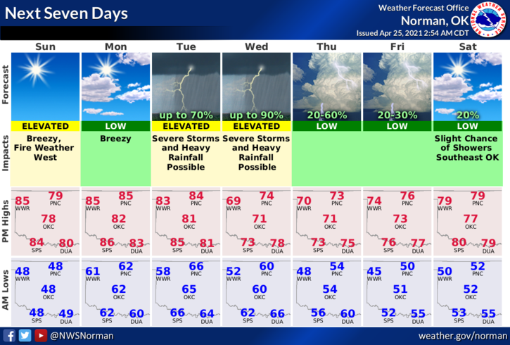
1-WINDY with fire weather conditions out west. That is dependent on where a dryline sets up later this morning into the afternoon. No folks, no storms today but there is a Grassland Fire Danger in our western most counties. It’ll be windy here along with a lower fire danger but as always, keep your eyes peeled for smoke and fire and then call 911.
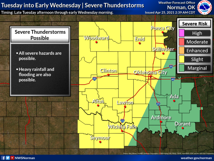
2- Severe weather is back in the forecast but depending on which model you look at; they seem to disagree with each other. That said, from Tuesday through Thursday off and on, expect periods of possibly severe weather. Tuesday afternoon through Wednesday morning may be the heaviest weather we may see as we have a storm system coming, a front, and a boatload of moisture coming in from the gulf. Add warm temps in the 80s and you have instability, and with the systems coming in, all the ingredients needed for severe storms are in the mix.
3- FLOODING RAINFALL is my biggest concern especially if deep moisture from the gulf comes into play. We’ll see what happens. Be prepared and know “before an event” what you will do if conditions become bad enough to take cover. Our GARFIELD COUNTY EM app can help in these situations so download it today, read up on severe weather, and become as knowledgeable as possible. Be sure to create a plan before you need it!
4- Here is your forecast from the NWS/NORMAN;
Sunday-Sunny, with a high near 79. South winds 10 to 15 mph increasing to 15 to 25 mph in the afternoon. Winds could gust as high as 32 mph.
Sunday Night-Clear, with a low around 62. South southeast wind 15 to 20 mph, with gusts as high as 30 mph.
HAVE A GOOD DAY!!
MIKE