0405L-SUNDAY OUTLOOK FROM GARFIELD COUNTY EMERGENCY MANAGEMENT-8/16/2020
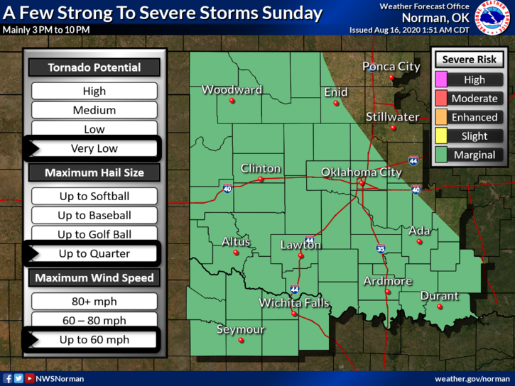
1- MARGINAL RISK for severe weather later today into tonight. Timing-roughly 3 to 10 pm. If storms do occur, downburst winds and hail will be the main issues along with torrential rainfall in the late afternoon and early evening hours.
2- Overall for today, do what you need to do but stay weather aware. If you plan on traveling, keep up with the latest forecasts from the closest NWS office in the area you are traveling. You can find all of them around us here- https://gcem.org/links/
3- Be sure to download our GARFIELD COUNTY EM app. You’re NOT prepared without it!
4- Here is your forecast from the NWS/NORMAN;
Today-Mostly cloudy. A chance of thunderstorms in the morning, then a slight chance of thunderstorms in the afternoon. Highs in the mid 80s. Northeast winds around 10 mph. Chance of thunderstorms 30 percent.
Tonight-Partly cloudy with a slight chance of thunderstorms. Lows in the mid 60s. Light and variable winds. Chance of thunderstorms 20 percent.
HAVE A GOOD DAY!
MIKE