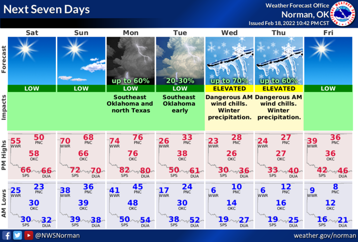
SATURDAY’S OUTLOOK FROM GARFIELD COUNTY EMERGENCY MANAGEMENT-2/19/22
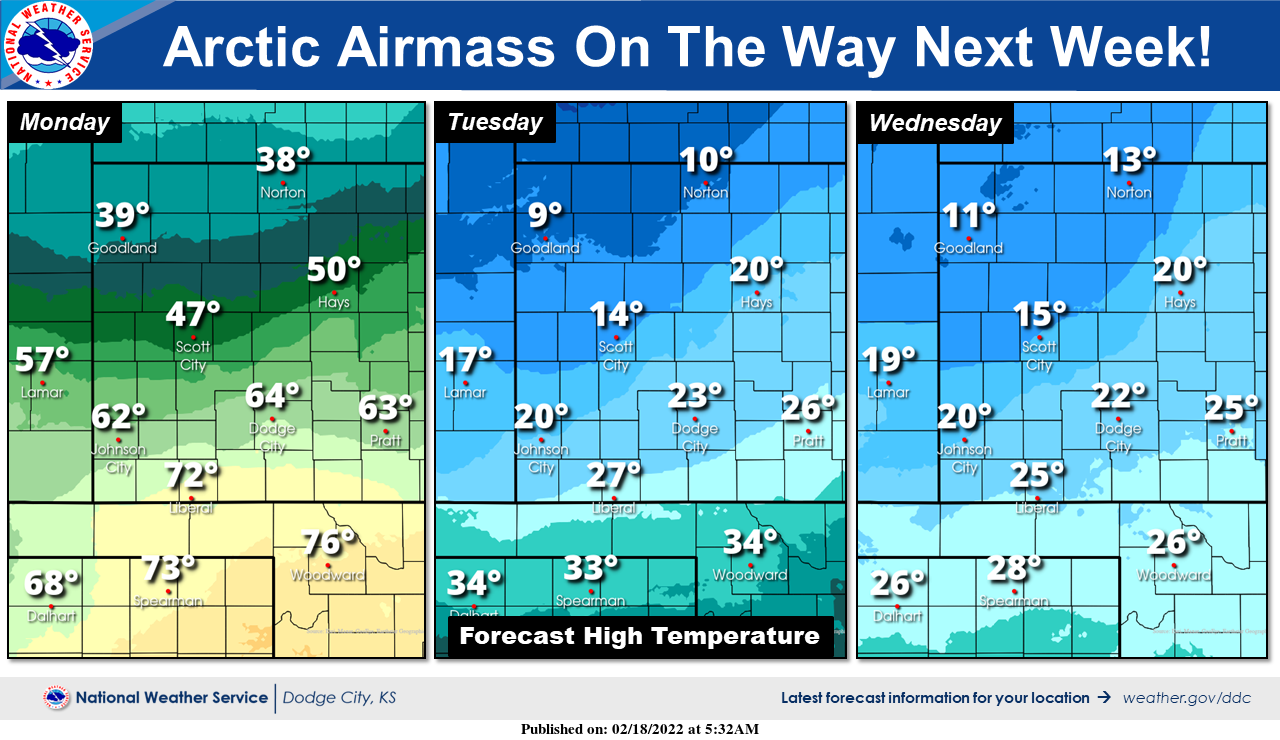
1- You have until Monday evening to enjoy warmer temps then the bottom appears that it will fall completely out for another 2 to 3 days. Can’t come out and say how much winter precip we’ll have this week but the cold will be ARCTIC AIR and the WIND CHILL temps will be DANGEROUSLY LOW. We all know what that means so take some time between now and then to prepare for another winter event.
2- If forecast temperatures are an indication, we should see mostly snow if precipitation occurs and most likely it will. For now, we’ll be ok so enjoy the slightly warmer temps through the weekend and on Monday. We’ll have more details as time moves forward. Here is your forecast from the NWS/NORMAN;
Today-Sunny. Highs in the mid-50s. Northeast winds 10 to 15 mph shifting to the southeast in the afternoon.
Tonight-Clear. Lows in the mid-30s. South winds 10 to 15 mph with higher gusts.
HAVE A GOOD DAY!
NOTE- The first graphic is from Norman and the second is from the NWS in Dodge City.