0335L-SATURDAY OUTLOOK & INFO FROM GARFIELD COUNTY EMERGENCY MGMT-2/29/2020
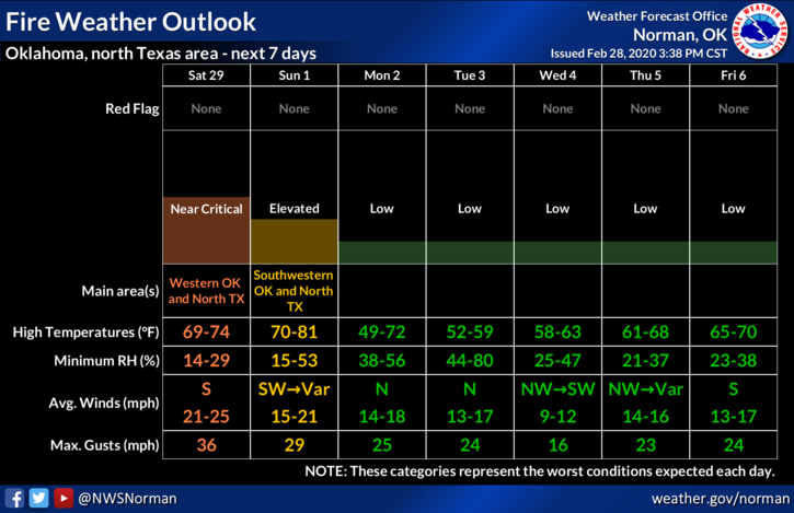
1-Higher temps, strong winds, low humidity and dew points will all be players in the FIRE DANGER today throughout the area. If anyone did a controlled burn yesterday, make sure it is out today as winds will whip up and any smoldering areas could cause fires you weren’t expecting. Remember, we have a Fire starter out there too so if you see suspicious activity, contact the Sheriff’s Office. If you see fire or smoke, call 911.
2-Rainfall, even next week, per guidance may be lacking in our area as the models are showing at this time. The better chance for rain may be the southern and eastern parts of the state. Keep this in mind if you plan on traveling. Remember this could change!!
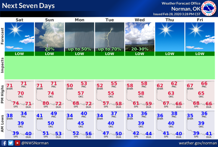
3- Overall, we’ll be warmer today so get out and enjoy as cooler weather will push back in as early as Sunday which depends on the timing of another front. This said, here is your forecast from the NWS/NORMAN;
Saturday-Sunny with a high near 70. South winds 5 to 15 mph increasing to 15 to 25 mph in the afternoon. Winds could gust as high as 29 mph.
Saturday Night-Partly cloudy with a low around 48. South winds 15 to 20 mph, with gusts as high as 25 mph.
HAVE A GREAT DAY!!
MIKE