0335L-SATURDAY OUTLOOK FROM GARFIELD COUNTY EMERGENCY MANAGEMENT-1/01/22
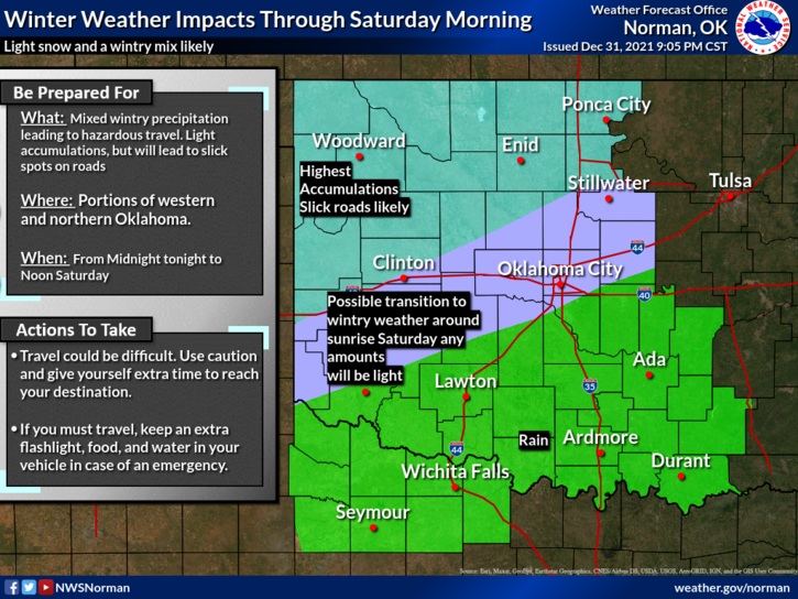
1- HAPPY NEW YEAR! We are in a WINTER WEATHER ADVISORY until noon today.
2- Light precipitation is possible this morning as this first wave pushes through the area. Colder and drier air will push in as the day progresses dropping temps even further. The wind chill will be the important problem so if you plan on being outside, cover up in layers. On the precip end, we can expect some light snow today. There could be some mixed precip in this too so just stay weather aware if you get out today.
3- Overall, we’ll be ok so stay in, stay safe, and again, HAPPY NEW YEAR TO YOU ALL. Here is your forecast from the NWS/NORMAN;
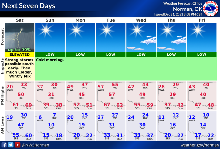
New Year’s Day-Light freezing rain, light sleet, and a chance of snow in the morning and this afternoon. Much colder. Highs in the upper 20s. North winds 20 to 25 mph with gusts to around 40 mph. Wind chill values as low as -7.
Saturday Night-A chance of snow in the evening. Colder. Lows around 5. North winds 15 to 20 mph. Chance of snow 30 percent. Wind chill values as low as the mid negative teens.
MIKE