0400L-SATURDAY OUTLOOK & INFO FROM GARFIELD COUNTY EMERGENCY MGMT-7/11/2020
1- HEAT ADVISORY IN EFFECT from 9am until 9pm this evening.
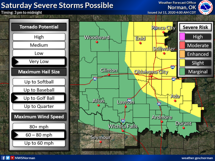
2- SLIGHT RISK FOR SEVERE WEATHER this afternoon into tonight.
3- Pertaining to #2 above, since our surprising MCS occurred yesterday morning we had a peaceful night. Today may be a different story as we warm up, we’ll get very humid, and the atmosphere will destabilize thus thunderstorms this afternoon into the evening and overnight hours. Some may be severe. Severe threats, IF STORMS OCCUR, are hail up to quarter size, winds up to 60mph, and the tornado threat is very low. Overall, we’ll see what happens and we’ll be ok.
4- Here is your forecast from the NWS/NORMAN;
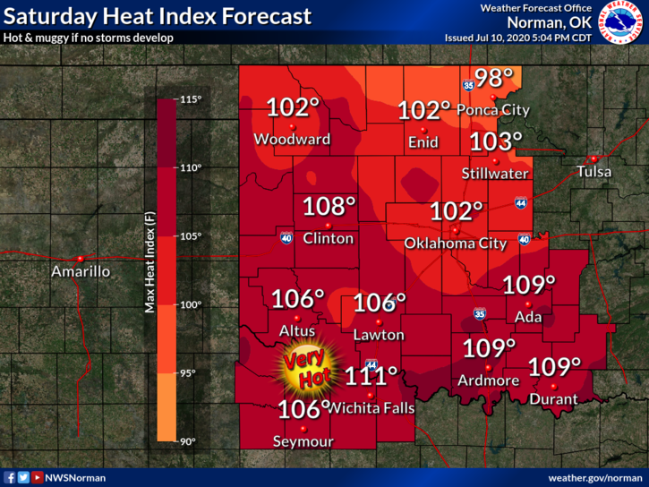
TODAY-30 percent chance of showers and thunderstorms, mainly after 4pm. Some of the storms could be severe. Mostly sunny and hot with a high near 99. Heat index values as high as 105. South wind 5 to 15 mph.
TONIGHT-50 percent chance of showers and thunderstorms, mainly before 1am. Some of the storms could be severe. Mostly cloudy with a low around 70. South wind 5 to 10 mph becoming north after midnight. New rainfall amounts of less than a tenth of an inch, except higher amounts possible in thunderstorms.
HAVE A GOOD DAY!!
MIKE