0435L-SUNDAY OUTLOOK FROM GARFIELD COUNTY EMERGENCY MANAGEMENT-7/12/2020
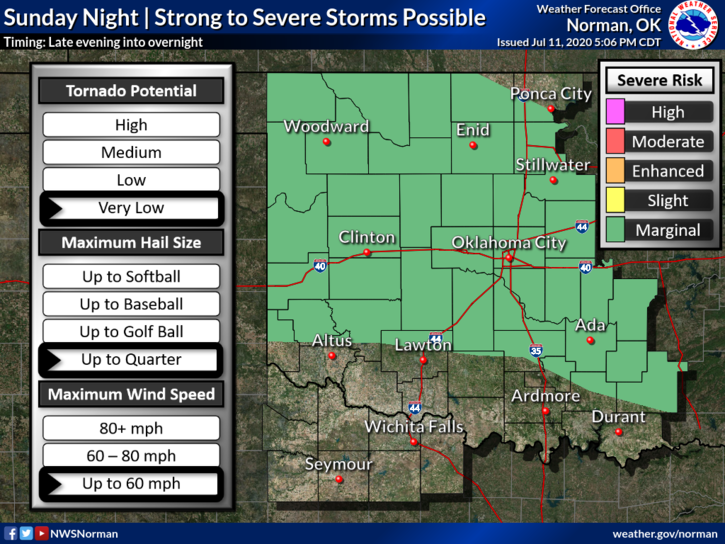
1- MARGINAL RISK FOR SEVERE WEATHER. Quarter size hail and winds to 60 mph are the threats. If storms occur, they will occur in the late evening and overnight hours.
2- Here is your forecast from the NWS/NORMAN;
Sunday- Sunny with highs in the mid-90s. Northeast winds around 10 mph.
Sunday Night-Partly cloudy with a slight chance of thunderstorms after midnight. Lows around 70. East winds around 10 mph. Chance of thunderstorms 20 percent.
3- Thanks for posting all the hail and storm pics last night. Just a reminder, I do not have messenger on my phone. Several folks were trying to contact me through that app. Just call me directly if you need something quickly.
Sorry this is late; I was on a fire east of Breckinridge until 230 am. Got home and fell asleep.
HAVE A SUPER DAY
MIKE