0340L-SATURDAY OUTLOOK FROM GARFIELD COUNTY EMERGENCY MANAGEMENT-6/17/23
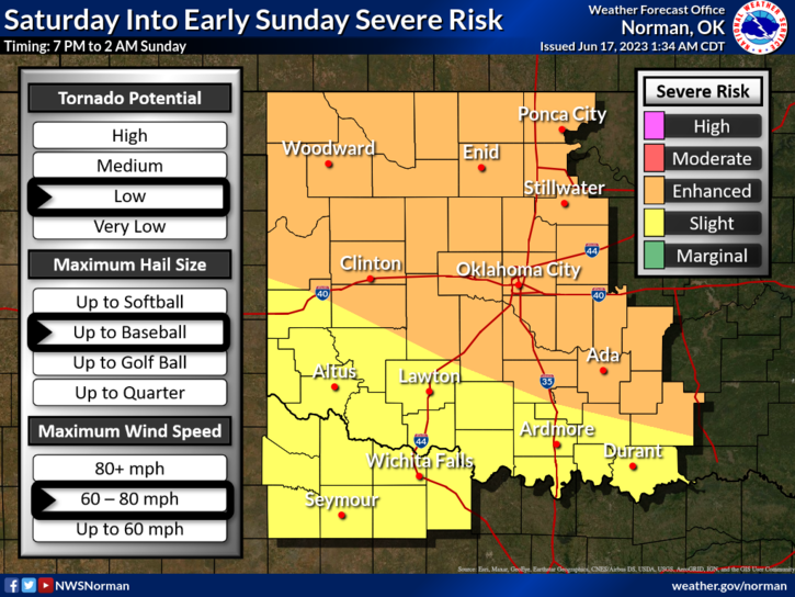
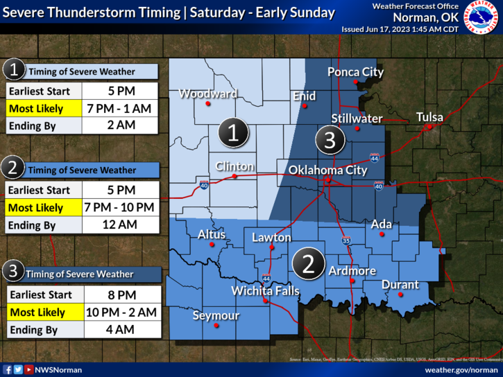
* ENHANCED RISK FOR SEVERE WEATHER LATER TODAY AND TONIGHT- Timing is roughly 1800L(6pm) to 0100 Local time. This will be similar to Thursday’s storm system. There will be 2 waves; one will be associated with a front and the second will be associated with storms coming off the high plains of Colorado later in the evening. The main threats will be high winds of 70-80 mph and very large hail. Storm track right now is difficult to determine but I would take the hail and threats later today seriously.
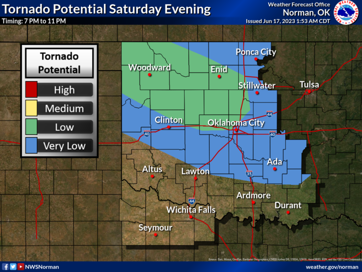
*Just be prepared for severe weather later today and this evening. Spotters will be put on stand-by once again in case the tornado threat actually comes into play. Will watch and adjust as needed. NO REASON TO PANIC, just secure things around the house and understand that there will be power outages when this occurs. OGE crews are prepared to respond as they can be, so have a few candles available and make sure laptops and cell phones are charged up by this evening.
-Overall, we should be ok so here is your forecast from the NWS/NORMAN;
Today- Sunny. Highs around 90. Northeast winds around 5 mph, becoming southeast this afternoon.
Tonight-Showers and thunderstorms likely in the evening, then showers and thunderstorms after midnight. Some thunderstorms may be severe. Locally heavy rainfall possible after midnight. Lows in the lower 60s. Southeast winds 5 to 10 mph, becoming west 10 to 15 mph after midnight. Chance of rain 80 percent.
*Be sure to download our GARFIELD COUNTY EM app. You’re NOT PREPARED without it.
Have a good day!