0255L-SATURDAY OUTLOOK FROM GARFIELD COUNTY EMERGENCY MANAGEMENT-6/24/23
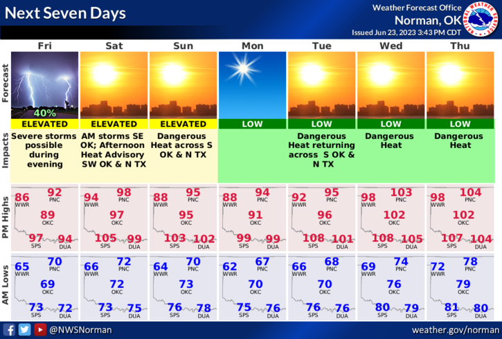
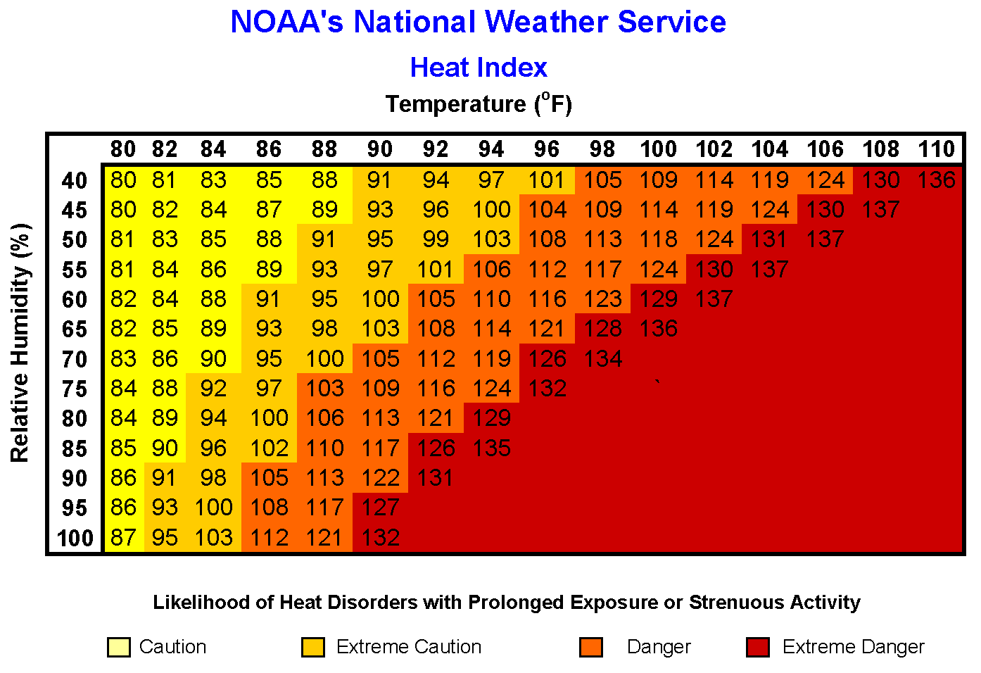
* The rain bows out and the heat is back. Temperatures will range from the mid 90’s today into the low 100’s by mid-week. Mid 30s Humidity and mid 60s Dewpoint temperatures will make it feel like 101 by mid-afternoon today so pace yourselves and take breaks if working outdoors.
*Snakes, frogs, and skeeters are on the loose out there so keep that watchful eye out if you live near any creeks or drainage areas around the city and county. With the heat coming back, so does the Fire Danger. Keep that in mind as we dry out this week. The ground may be soggy in some areas but everything above ground will be dry so use extreme caution out there if utilizing anything related to fire.
*Overall, it will be hot so be prepared for that and stay hydrated. Here is your forecast from the NWS/NORMAN;
Today- Partly cloudy after midnight, then becoming sunny. Highs in the upper 90s. South winds 10 to 15 mph, becoming southwest this afternoon.
Tonight- Clear. Lows in the upper 60s. West winds around 5 mph, becoming northeast after midnight.
*Be sure to download our GARFIELD COUNTY EM app. You’re not prepared without it!
HAVE A GOOD DAY!