0425L-SATURDAY OUTLOOK FROM GARFIELD COUNTY EMERGENCY MANAGEMENT-3/2/19
WINTER WEATHER ADVISORY IN EFFECT FROM 6PM SATURDAY EVENING UNTIL NOON ON SUNDAY.
ROAD CONDITIONS ALL AROUND THE REGION CAN BE FOUND ON THE FRONT PAGE OF OUR gcem.org WEBSITE.
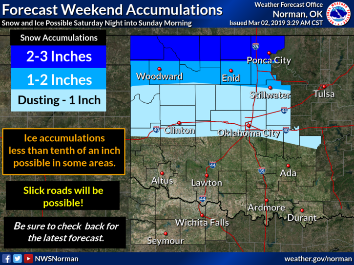
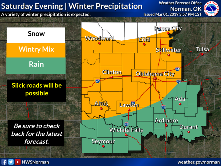
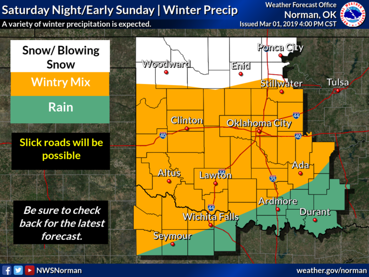
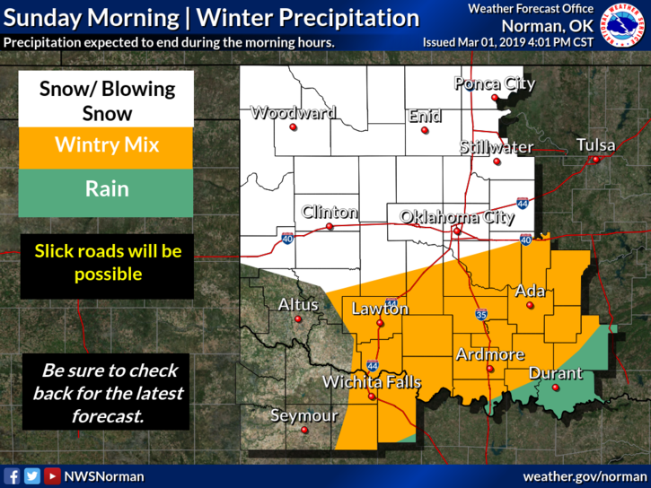
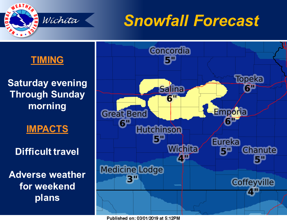
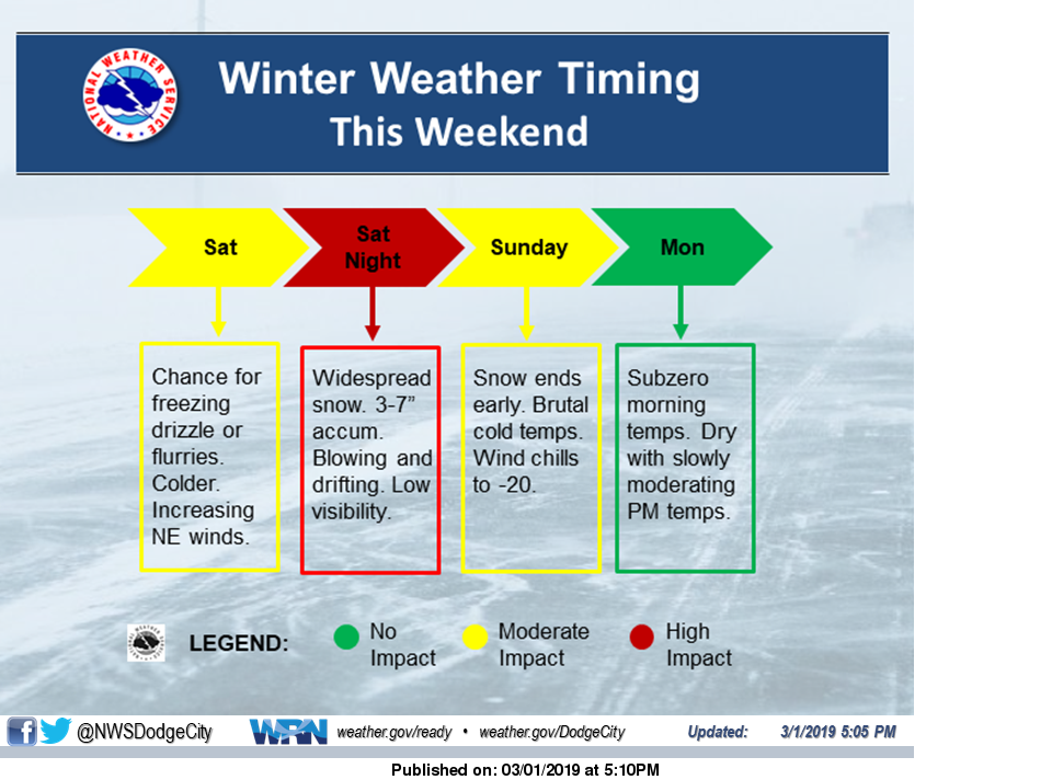
1) WE ARE EXPECTING PRECIPITATION TO BEGIN LATER THIS EVENING AND DURING THE OVERNIGHT HOURS. Just FYI, we’re not going to die or be snowed in for a week and there’s no need to panic. See the attached graphics and understand that these will change some during the day.
2) ALSO, understand that we MIGHT see some freezing precip before the snow. There are many variables still to be determined but overall we should see some accumulating snow.
3) Download our GARFIELD COUNTY EM app as updates for the most part will be sent over it.
4) Here is your forecast from the NWS/NORMAN;
Saturday-Cloudy, with a high near 36. Northeast wind around 10 mph.
Saturday Night-Snow, mainly after midnight. Patchy blowing snow after midnight. Low around 17. Northeast wind 8 to 18 mph, with gusts as high as 25 mph. Chance of precipitation is 90%. New snow accumulation of 1 to 2 inches possible.
HAVE A GOOD DAY!!
MIKE