0400L-SATURDAY OUTLOOK & INFO FROM GARFIELD COUNTY EMERGENCY MANAGEMENT-10/26/19
1-GARFIELD COUNTY EM– This is our notification app. You will receive info from GCEM, GCSO, EPD, & the NWS when we all see the need to share information to our public. Remember, we won’t send information out every day but we will send it as needed. We do this for PUBLIC SAFETY, not public panic.
2- Next week’s weather will be unique. Since the models are saying different things right now, expect colder air, possibly snow late Monday and also Wednesday into Thursday and we’ll most likely see a good killing freeze this week. There are many variables right now so we’ll take this one day or so at a time. Make sure you have winterized at home and at work.
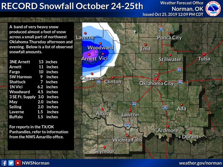
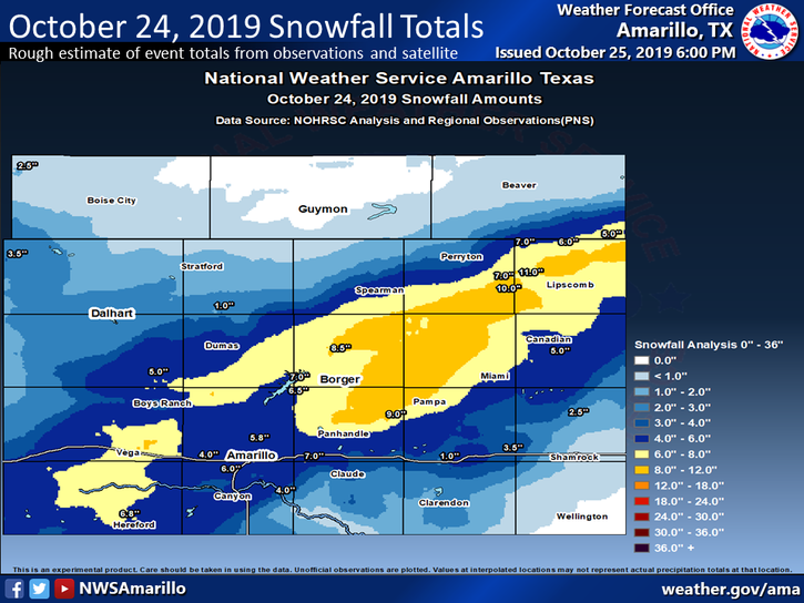
3- I have added 2 graphics, one from the NWS/NORMAN and another from the NWS/AMARILLO on snow totals. We didn’t receive snow but we received 1.5 inches of rainfall. Either way, its precipitation. Don’t worry folks, we’ll receive some snow, soon.
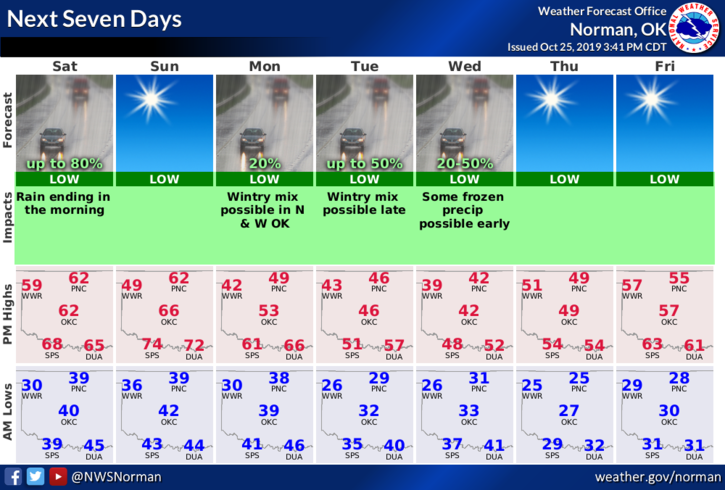
4- Here is your forecast from the NWS/NORMAN;
Saturday- Sunny. Not as cool. Highs in the lower 60s. Light and variable winds.
Saturday Night-Clear. Lows in the upper 30s. Light and variable winds becoming southeast around 10 mph after midnight.
HAVE A GREAT DAY!!
MIKE