0410L-SUNDAY OUTLOOK & INFO FROM GARFIELD COUNTY EMERGENCY MANAGEMENT-10/27/19
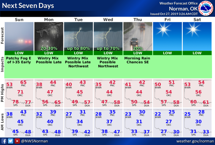
1- A cold front will push in sometime this afternoon bringing cooler temps. Exact timing isn’t known but we’ll gradually cool down. This front should be dry. Tomorrow another front will bring even cooler air and a possibility of some light winter precip overnight. Wednesday into Thursday, we may even see more snow. We’ll see what happens.
2- Yesterday I stated we would see our first hard freeze and that looks to be on track as we may see low temps in the mid to upper 20’s for several hours. Just make sure you are prepared for this.
3- Overall, we’ll be ok so here is your forecast from the NWS/NORMAN;
Sunday- Sunny with a high near 59. Southeast wind 5 to 15 mph becoming north in the afternoon. Winds could gust as high as 21 mph.
Sunday Night-Partly cloudy, with a low around 39. North wind around 16 mph, with gusts as high as 23 mph.
Finally; download our GARFIELD COUNTY EM app. You’re not prepared without it.
Mike