0330L-SUNDAY OUTLOOK FROM GARFIELD COUNTY EMERGENCY MANAGEMENT-12/12/21
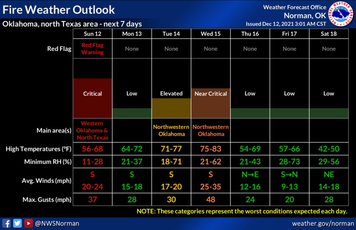
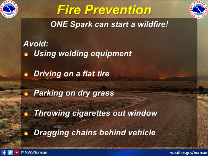
1- Warm and windy with a critical Fire Weather situation brewing. There is a RED FLAG WARNING in effect covering the western 1/3rd of the state. We aren’t in it at this time. Conditions will dictate that as the day and the week progress. Either way, use extreme caution while utilizing ANYTHING related to fire and NO CONTROLLED BURNING TODAY. Call 911 if you see smoke and or fire. Thanks.
2- Weather-wide, we will be warmer as the week progresses with a slight chance for possible showers by mid-week. We are expecting a fairly strong front by mid-week and a stronger front by next weekend. There are several variables out there on what may happen so I’ll wait to state anything close to definite, until a few days before.
3- Here is your forecast from the NWS/NORMAN;
Today-Sunny. Highs in the lower 60s. South winds 10 to 20 mph increasing to 20 to 25 mph in the afternoon gusting as high as 35 mph.
Tonight-Clear. Lows in the mid-30s. South winds 10 to 20 mph gusting as high as 35 mph.
Finally, Fire weather information for fire personnel will be sent out around noon over the GARFIELD COUNTY EM app.
HAVE A GOOD DAY!