0415L-SUNDAY OUTLOOK FROM GARFIELD COUNTY EMERGENCY MANAGEMENT-7/17/22
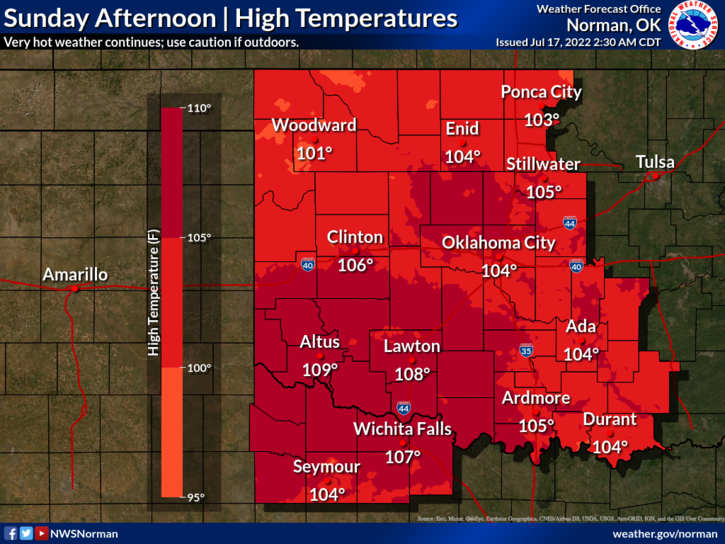
1- HEAT ADVISORY REMAINS IN EFFECT FOR TODAY FROM 1PM UNTIL 8PM TONIGHT. HEAT INDEX VALUES AS HIGH AS 107 ARE POSSIBLE.
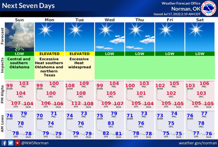
We will be under an “EXCESSIVE HEAT WARNING” ON TUESDAY.
2- Here is your forecast from the NWS/NORMAN;
Today-Mostly cloudy this morning, then becoming mostly sunny. Hot with highs around 104. South winds 5 to 10 mph, becoming northwest this afternoon.
Tonight-Mostly clear. Lows around 70. Northeast winds 10 to 15 mph. Heat index values up to 106 early in the evening.
3- We do have a front that will push in bringing a wind shift with it. Cooler air should keep temps around 100 on Monday and we warm up to dangerous temps on Tuesday around 111 degrees.
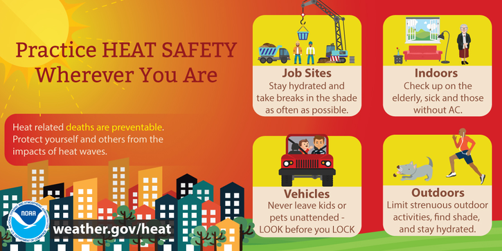
4- Looking forward to fall/winter because you can only take so much off to stay cool. For those working outdoors, use EXTREME CAUTION and pay CLOSE ATTENTION to how you’re feeling.
STAY COOL!