0322L-SUNDAY OUTLOOK & INFO FROM GARFIELD COUNTY EMERGENCY MANAGEMENT-7/31/22
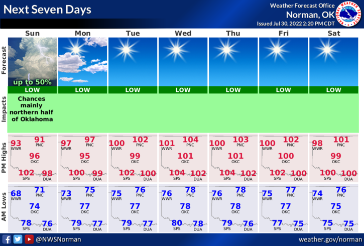
1- THUNDERSTORMS ARE ON THE WAY EARLY THIS MORNING. Nothing severe is expected but heavy rainfall along with lightning and thunder should occur around 4 am give or take. That said, here is your forecast from the NWS/NORMAN;
Today-Mostly cloudy with a chance of showers and thunderstorms this morning, then partly sunny with a slight chance of showers and thunderstorms this afternoon. Highs in the lower 90s. Heat index around 99. South winds 10 to 15 mph with gusts up to 25 mph. Chance of rain 50 percent.
Tonight-Mostly cloudy in the evening, then becoming partly cloudy. A slight chance of showers and thunderstorms. Humid with lows in the mid-70s. Southeast winds 5 to 10 mph. Chance of rain 20 percent.
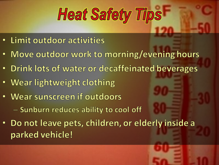
2- After today and much needed rain and cooler weather, the heat returns on Monday. I am talking the return of the heat dome so all heat related warnings and advisories may come back each day. Most will depend on how humid we may be. With the rain, mosquitoes will return too, so empty ANYTHING that holds water outdoors.
3- Remember, use good common sense when working in the heat and stay hydrated.
HAVE A GOOD DAY!